A few months ago, the local chapter of the EAA in Santa Monica was going to organize a Young Eagles day. For the uninitiated — that’s when pilots give rides to a bunch of kids for free to get them introduced to aviation and the like. Wanting to give back, I signed up and went to the pre-flight briefing etc, only to have us cancel on the day of the flight due to crummy weather. No need to teach kids that aviation is all about staying at 1,200 ft and almost violating cloud clearance and minimum altitude regs, right?
So a few months passed, and the chapter started organizing another flight. I eagerly signed up, and went to the briefing. The plane is full of fuel, the weather for the weekend looked to be grand, I’m VFR and IFR current, so… all is good, right?
Nope. Not to be outdone by the WX, the other devil of aviation reared its head — the dreaded MX.
See the beautiful picture intersected by a rather funny looking stick? Yup, that’s my propeller, with a strange looking problem at its tip. Instead of a leisurely pre-flight the day before carting young kids around, I ended up having to ground the airplane and begin the process of spending untold amounts of money to fix the spinny thing that keeps my airplane going. So now I’m two maintenance items in arrears — a fix for this prop issue, and ADS-B installation. And on its heels will be my annual inspection. So there’s clearly not a lot of flying that I’ll be doing in my airplane in the next couple of weeks for sure, and possibly longer than that.
Argh. Doesn’t everyone love the joys of airplane ownership?
A few weeks ago (before beginning a new job, which made me apparently not only less likely to fly but also less likely to post), I finally had a chance to take my instrument checkride.
Spoiler: I passed!
There was some drama about a fuel pump, a mid-flight misunderstanding, and a rather unusual (if you ask me) way of doing partial panel where the examiner turned off my PFD but did not allow me to engage reversionary mode, which meant that I was doing a GPS approach using the map as my only means of lateral navigation. Still, it all worked out.
Now I have to consummate this rating and go on an actual IFR flight. Which, given that the weather turned nice and that flying companions are suddenly busy and rare, ended up being harder than expected to organize.
Yesterday, I took my sister on her first flight in the Diamond. We were going to grab lunch somewhere, and it gave me an excuse to get an extra couple of hours in the airplane.
The weather was what I’d have considered unflyable just a year ago — scattered to broken layer at 2,000-ish feet AGL, sometimes higher and sometimes lower. Lots of fairly solid cumulus clouds covering the entire LA basin. Some airports reporting overcast below 4,000ft AGL. But also stable-and-improving weather throughout the region forecast, and the broken layer not descending, and lack of any ceiling forecast further inland. So with I figured that as long as I retained a ton of flexibility of where to go and how to get there, I would be fine to go.
We flew to Camarillo for lunch. Starting in Hawthorne, we had to go around the LAX Bravo, rather than climb over it (clouds). This isn’t my favorite way of getting around LAX: you make controllers and aircraft on approach to LAX nervous; you have to deal with turbulence; you are forced to fly it around 1,500ft and you end up being concentrated into the same place as everyone else trying to get around the Bravo without being on a shared frequency. I tend to get flight following, when I can, and in this case it helped — after getting past the approach for Runway 25R, the controller cleared me into Bravo and let me cut the corner of the surface shelf so that I can more easily avoid some traffic that was attempting to take the same path as I was.
Generally the rest of the trip was uneventful, though I stayed below 3,000 ft most of the way for clouds, and had to do a bit of route selection to stay away from the cumulus buildups. After crossing into Thousand Oaks, the lower cloud layer disappeared and we landed in Camarillo nicely — for practice purposes, I loaded in the RNAV approach and let the autopilot fly me to the minimums.
After a long wait and a nice lunch, we headed back. This time I wanted to try the coast rather than going inland via Van Nuys, and to see if I could make it back via the Special Flight Rules corridor. On takeoff I proceeded to Pt. Mugu, but the cloud layer kept us at 1,000 ft AGL which was lower than I had hoped. Mugu, after clearing our transition, asked if I was going to climb any higher and I told them I’d wait to round the mountain to the coast to see what the clouds were doing before deciding — but once I did, it still wasn’t obvious. I could get to Santa Monica — I could see far enough at my altitude to see that the coast itself was unobscured, but I didn’t want to do the whole flight at 1,000ft if I could help it. Turn back or continue going? Hm.
Suddenly though I saw some blue sky just over the mountains. A nice hole in the layer just for me — I turned the plane and climbed quickly over the layer which topped out at around 2,500ft, and proceeded back to SMO at 3,500 inbound towards the Special Flight Rules. My sister got an awesome view of the pretty cool cloud layer.
However, as we got closer to Santa Monica I started doubting my plan. Ahead of me I could see the cloud layer get higher up. I couldn’t tell exactly where it was, but possibly it started before I’d be out of the SFRA. In addition, while it looked like it was going to continue to be below my altitude, I couldn’t be completely sure — and even if it was below, I didn’t think I could keep my cloud clearance minimums.
So, more choices. I could continue, and worst case turn around. This could work, but then I’d have to do some maneuvering over LAX — I didn’t like the idea of doing that. Plus I would have to not just turn around but also climb an extra 1,000 ft in the turn. Instead, I could turn north and head towards Van Nuys — the layer stopped there, so I could duck down and go either through the Sepulveda pass (unlikely) or around Downtown LA (very likely) — with the backup plan being to land in Van Nuys for the day.
Fortunately, a third plan presented itself in the form of another hole in the cloud layer below me. With enough horizontal clearance, I told Santa Monica that I wanted to transition, dove down to 1,500ft, and then proceeded around the Bravo shelf back to Hawthorne. In all, I was able to safely complete a VFR flight without creating what felt like undue risk, or coming close to violating regulations, or placing myself in a situation with few outs. I always left myself room to turn around and try another approach, and never felt nervous about the choices I was making. I think that if I hadn’t had IR training, and hadn’t gone on the long trip to Toronto, then I wouldn’t have wanted to try flying in this weather for fear of the unknown.
Anyway, all that that brings me to the most funny part of the trip. With the plane all tucked away and shut down, we got in the car and headed for the exit. And it was after about fifteen seconds of driving that I realized where I was — tracking the centerline of the taxiway. After an hour of flying, I hadn’t transitioned from flying to driving fully, and must have still thought absentmindedly that I was in an airplane. Let’s hope that the tower didn’t care enough to report me as I sharply veered back to the roadway.
With a new airplane, and a summer of no school for the kids and no full-time work for myself and Linda, we decided to try to embark on a long, literal cross-country trip to visit Linda’s relatives in Toronto.
There are so many factors for this. With some (written and verbal) help from Colin, I planned out some of the key steps of preparation. First, I made sure the airplane was current on inspections, and that things that weren’t working as well as I wanted were nice and happy. This meant getting a 50-hr PowerFlow exhaust check done, and a 100hr fuel injector line inspection, and making sure my oil was reasonably recent, and solving a problem with a hotter-than-others cylinder. Eventually, I felt ready mechanically.
Second, I needed a route. To cross the Rockies, I decided on a flight through Lake Havasu (KHII), which I was familiar with from the Prescott flight a few years ago. Then we’d go to Albuquerque where we have friends who could host us for the night (and give the kids a few friends to play with). Then, we’d try to fly northeast and try to get to Chicago, where we might be able to spend an extra day or two and take kids to various museums etc. And then we’d cross over the border to Canada and fly to Toronto.
With a rough route in mind, the next step was preparing for the border crossing. Following a nice guide from AOPA, I just had to go through a series of steps and make sure that everything came together on time. This meant getting my permanent registration papers (which barely came on time), getting the FCC radio paperwork (supposed to take weeks, but actually took two days and was delivered electronically), getting the DHS decal (came maybe two days before departure), making sure the insurance was correct (it was in my name, while I actually registered the plane in the name of an LLC), signing up for eAPIS and ensuring our passports were current, getting my drivers license renewed (also barely done on time), and a few odds and ends.
Then came the weight & balance worries. My plane has a pretty low useful load and poor balance — one advantage of a late-2007 Diamond Star is that 50-gallon tanks came standard and you can fly longer legs, but it comes at a cost of W&B issues when the airplane has more than two people in it. The useful load is 835 lbs, and with 50 gal of avgas that leaves me so little weight that with two adults and two kids we’re actually overweight. If we fly with 40 gallons instead of 50, we are underweight and can bring some baggage, but again have to watch what we take and where we put it (plus we have to constantly deal with getting under 40 gallons in the tank). In the end, we were limited to 45 lbs of baggage, and that included airplane equipment like tie-downs and spare oil etc. Plus, my dad insisted that if I take my wife and kids, we must bring a bunch of spare water in case we have to land in the desert somewhere. So, in the end, we fit, but at the cost of going down to about 4 days of clothing, and not being able to bring books (though Kindles are magic).
In the last few days before departure, a new problem arose. The day before we intended to depart was the first day of a gigantic heat wave that was hitting southwest of the US, and one effect of this was that Lake Havasu was going to be 49º C during the day, and basically above 40º all day after 9am. I didn’t want to put either my airplane nor my passengers through a landing, taxi, and departure in that heat. So instead we decided to make our first stop in Flagstaff, AZ, assuming that noontime thunderstorms were not going to be a problem.
We departed on Wednesday morning, running about 90 minutes behind schedule. This was Linda’s first long flight with me (and the first flight in the new airplane), and Roan’s second flight with me (and also the first in the new airplane). Departing from Santa Monica was pretty easy, despite a few clouds in the area, and we proceeded through the Banning pass climbing up to 9,500 ft, and then proceeded direct to overfly Lake Havasu. That’s when we ran into some turbulence, and some scattered precipitation. I have two sources of in-flight weather: ADS-B In (from a Stratux), and XM Weather. These two were actually decently useful at providing an up-to-date picture of what was going on ahead of me, and — combining it with what was visible out of the window — made it possible to scoot
An FBO cat called Cessna
around clouds giving them enough room when need be. The hills provided some bumps at first, and often made it hard to keep altitude: the autopilot would attempt to maintain a certain altitude, but I suspect that the hills and weather caused pockets of different pressure that constantly drove the indicated altitude up or down. The autopilot would then try to adjust, either trying to climb at some slow speed, or speeding up on the way down to altitude.
At times, I’ve had to switch into pitch mode so that the autopilot wouldn’t try to get me close to stall speed.
Above the glide slope at Flagstaff
Landing at Flagstaff was reasonably easy, though it’s a high density airport and I had to plan for a faster-than-usual sink rate and a longer-than-usual rollout. We parked at the Wiseman FBO, where they were super-awesome, let us play with their FBO cat (named Cessna), and gave us a crew car that we took to town to get lunch.
Getting out of Flagstaff proved to be a bit challenging. First, weather in the form of precipitation and thunderstorms was coming in from the west — and we were trying to get out and continue east.
When we got back to the FBO, we had to scoot pretty quickly and figure out how to depart the area given the thunderstorms that we could see on radar — it was far enough away to not affect the airport yet, but I didn’t want to get trapped by a system that was going to move in for many hours. Flagstaff is a high-altitude airport, and the plane was fully loaded, and it was surprising how poorly the airplane climbed — during the takeoff roll I had to make a decision whether to actually reduce mixture from where I had it set, or to abort the takeoff. With a lot of runway in front of me, I found a position that generated more power and we lifted off, but still climbed pretty sluggishly for the next five minutes. I have taken off at altitude in the past, and I knew to expect poor performance and the need to adjust the mixture, but I’d moved it since runup and thus wasn’t in the best-power setting when I started my roll. Lesson learned.
This leg took us over even less hospitable terrain with more bumps. We climbed to 11,500 ft for a time to keep well above the cloud layer, and that helped with the turbulence a bit too. Both the kids were deep in reading or watching some movie on the computer in the back, so this was not so much because they were complaining but because I didn’t want a repeat of the first leg where we had to work hard to keep altitude.
Landing at Albuquerque was straightforward and this time I was better prepared for higher-altitude performance; we parked at Cutter and left the airplane for the night. Time to go visit our friends and spend the night in Albuquerque. Which we did, watching the lightning and listening to the thunder of the storms passing overhead.
Our intent the next morning was to a) leave early enough that the thunderstorms don’t start developing yet, and b) go to Liberal, KS, which was on the way. The first part was fine — we got up early and got to the airport. The second part turned out harder: first, our airplane wasn’t ready (the FBO had to pull it out of some hangar or tie-down spot), and second, Liberal wasn’t a good place to go. My instinct told me it was iffy, and so I called a briefer (usually I brief on the iPad) — with the briefer explicitly not recommending VFR flight to Liberal due to radar echoes and low ceilings, I decided we would go further south to Amarillo, TX instead. If the weather there was also not great, we would find yet another place to head to further south still. The ceilings were not that low and were not forecast to be low in enough places within our non-reserve range, and so I felt this was a reasonable plan.
Amarillo (which for some reason is pronounced with “L” sounds and not “Y” sounds) is in the Texas Panhandle, and is basically directly east of Albuquerque. We climbed to 11,500 ft and cruised over to Amarillo without any problems. Amarillo was impressive in that it was an airport seemingly in the middle of nowhere, and yet there was so much traffic reported by the tower that we were sent on a very long downwind and then asked to do a 360 for spacing. Right above the airport was the meeting point of a bunch of Victor airways — 10 radials of the on-field VOR are used as airways — and so there was high altitude jet traffic as well as low-level airport traffic. The airport was also a hub for military airplanes: we parked at TAC Air and had lunch at the on-field restaurant, but in the meanwhile the FBO was refueling a fighter jet. Pretty awesome.
Liberal was still not a good choice, but we were far enough east that we could head northeast without running into the weather. I was originally hoping to get to Kansas City that day, but my fallback was Wichita and so that’s where we headed due to distance and time considerations: I didn’t want to have a 3-hour flight where a 2-hour one would suffice. We climbed to 9,500, but then realized that the cloud layer was in the way — and so both went around and decided to go under it, since ceilings for the rest of our path looked to stay high enough. We eventually dropped down to 5,500 ft, and then even to 4,000 ft (which was less than 3,000 above ground) to avoid clouds.
Wichita was a pleasure to arrive in — the land below turned green and lush, and it was becoming evening-time. However, there was a nasty cross-wind and we landed a bit rougher than I had wanted (nothing that my passengers noticed, apparently, but enough that I was unhappy). Another thing that was unhappy was my fuel pressure gauge, which took the opportunity of the landing rollout to start going haywire: showing zero, max, correct readings, and alternating between different ones multiple times per second. This was accompanied by audible ding-dongs from the G1000 system. We were on the ground, though, so I taxied to the FBO — Yingling Aviation — and shut down.
After getting our stuff out of the airplane, and refueling, I started troubleshooting the issue. Was this a fuel leak? No, cause nothing was leaking out. Was I actually experiencing fuel pressure issues? Was there vapor in the lines? I started the engine and ran it through different mixture settings, different RPMs, with and without a fuel pump, etc — the gauge kept jumping when the engine was on (but not during priming with the engine off). A mystery.
Landing in Wichita
Fortunately, Yingling has a maintenance shop. And the city is one where not only are Cessnas, Beechcraft, and other airplanes are made, but also Textron and Garmin offices were local. The maintenance shop was open, and a very helpful guy sat down with me for a bit to take a look at the problem. We looked at the maintenance manual for the G1000 and found the part number for the fuel pressure sending unit — which happened to be made by a Wichita company — and he promised to look at it over the rest of the evening. By then my family already took a shuttle to the hotel, and I joined them soon after by Uber. The plane would sit in a hangar being looked at. So, four legs in, I had a maintenance issue which could ground us.
After some back and forth, the Yingling folks have taken off the fuel pressure transducer, cleaned the contacts, and started the engine to see everything working well. So, we decided to call the problem done. We spent the evening walking around Wichita’s river bank, looking at the Keeper of the Plains, and then in the morning headed back to the airport.
We decided to go land at the Spirit of St. Loiuis airport — it’s on the outskirts of St. Louis, but convenient with a good FBO (Aero Charter). The flight was a bit more eventful, as we had to deal with clouds at our altitude and had to climb to 9,500ft for a good chunk of the trip. We flew over the beautiful Ozark lakes, and the terrain got greener and more lush. St. Louis was reporting a broken cloud layer, so we descended through the plentiful holes and landed after a few turns in the pattern over the winding Missouri river.
Landing at Spirit
Missouri River
Gateway Arch
While this was just a fuel stop, we were hungry, and borrowed a crew car from the FBO. After getting food very quickly, we decided to go check out the Gateway Arch in downtown St. Louis, and so ended up with a 30 min trip each way and an a half an hour walk around the Arch area. Time well spent, as the arch and the general area on the bank of the Mississippi was both well maintained, pretty, and worth seeing.
After getting our fill of St. Louis, we climbed back aboard for another two-hour hop to Chicago. Initially, I wanted to end up at the DuPage Airport near Chicago, though from past experience this is actually not a convenient place to downtown and would have required a pricey Uber ride. On the other hand, the airport in Gary, Indiana, was billing itself as the “Gary/Chicago” airport and boasted a 30 minute distance from downtown. There was also a threat of some weather around the city, so we aimed at Gary.
Immediately after takeoff, the fuel pressure problem started again. Though distracting on takeoff, I quickly analyzed it again to not be a real fuel pressure problem, and decided to continue on to our destination — choosing an FBO at Gary that advertised maintenance services. The flight was smooth, though the incessant beeping from the fuel pressure alarm was incredibly annoying. I ended up keeping either myself, or myself and Linda, isolated from the kids so that they could watch movies or read in peace while we (or I) dealt with the beeps.
We arrived at Gary shortly after sunset — this was my only evening landing, as it happened. There was absolutely no wind, and I made perhaps the smoothest approach of the trip.
The FBO had two surprises for us, however. First, it turned out that their maintenance folks were closed for the day — and weren’t going to be around during the next two days which were the weekend. Second, the airport was more like an hour away from downtown Chicago by Uber. We booked a hotel and climbed into an Uber, and only made it to Chicago after 10pm — and between hotel check-in and dinner with the kids, we only managed to go to bed after 11:30pm.
Exhaustion hits
The next day was spent exploring Chicago. We went to the Museum of Science and Industry, and the Shedd Aquarium, and had deep dish pizza, and walked around a bit. We decided to try to go to the Field Museum on the following day, a Sunday.
But on Sunday, we didn’t go to the Field Museum. There was a threat of impending poor weather later in the day, and we wanted to get to Canada before Linda’s relatives started flying back to their homes, so we decided on a Sunday morning departure.
Once again, we took an hour-long Uber ride to Gary, and then I had to figure out all the details of actually setting us up for crossing the border.
US / Canada border.
Crossing the border is a tricky affair. Three things had to happen: 1) I needed to be on a flight plan, which meant that I needed to file my departure time and ETA; 2) I needed to file my departure plan in eAPIS, including my departure time and location, arrival time and location, and estimated time when I’d be crossing the border; 3) I had to call up Canadian border patrol and let them know when to expect us. Given that all of these needed time information, I gave them a generous padding for departure — and yet, it took almost thirty minutes of hold time with Canada before I got through to a human, which delayed my departure and made me incorrect on at least some forms I’d filed.
Canadian folks asked fairly basic questions about the aircraft, and then wanted our passport information. They then said to call them once I landed in Canada, and we rushed to take off before our due time expired.
Apart from the incessant bong-bong-bong from the fuel pressure alarm, the flight was uneventful. We followed the south coast of Lake Michigan, and then cut over all of Michigan to the point where Lake Huron starts flowing south towards Lake Erie — and that’s where we crossed the border. Detroit Center had us switch to Canadian ATC (Toronto Center, I think), who promptly had us switch to the advisory frequency for Sarnia Airport. I self-announced and we landed in our first un-towered landing of the trip.
GPS guidance ending on the US side of the border.
Some new discoveries along the way. First, I didn’t load Canadian airport database into the G1000, which meant that the plane had no idea where Sarnia Airport was. Fortunately it was right next to the border and quite visible from the air, but it was a bit unnerving. Second, because the G1000 had no idea an airport existed at a particular location, the device started freaking out as I descended — my synthetic vision system started turning the screen yellow and then red, and warning about terrain first via visual notes and then by having a voice say “terrain, terrain”. I warned Linda and the kids as soon as I realized this was about to happen, but it was still a bit unnerving for them.
I had two choices for navigation (other than using paper charts, which I had at hand too). I could have reloaded the Garmin databases. This was going to be troublesome since it wasn’t clear to me that I could switch between US-only and all-of-North-America options at will. It seemed like I could only make the choice when subscribing for the year. I could also subscribe to ForeFlight’s Canadian coverage, which would give me taxi diagrams and Canadian VFR maps on my iPad. I chose to go for the latter, even if it didn’t set me up in the G1000, simply for the convenience of planning my routes on the ground. I assumed I’d be navigating visually anyways and could still use the G1000 direct-to navigation using user waypoints or even just random places on a map — and since the city of Kitchener, Ontario, was on the map, and was where my airport was, I felt reasonable about this plan.
Waiting on the phone for Canadian border patrol to allow us to get out of the airplane.
We landed in Sarnia, and taxied over to the FBO. A nice gentleman approached us and confirmed that we had to sit in the plane until we got Canadian border patrol on the phone to release us — they could have let us in right away, or could have sent a person to inspect us. Due to the Oshkosh convention that was just finishing up, it seemed like we might be on the phone for 45 minutes according to the man, and then up to two hours waiting for an inspector.
Very fortunately, I only waited 5 minutes on the phone until some nice Canadian border people heard that we landed and told us Welcome to Canada, gave us a reference number for the entry, and that was it. We disembarked, and Linda and the kids went into the FBO (Huron Flight Centre — really just a flight school, I believe). I stayed behind to get the plane fueled using a pump denominated in liters rather than gallons. Fun times ensued.
The weather system that I was concerned about that morning was now very much established over the part of Ontario where I was attempting to go, but was sitting slightly south and west of our airport, and moving slowly eastward. We departed as soon as practical to try to make it to our airport.
Lake Huron
Initially, I had wanted to go to CZBA, which is a small untowered airport just a few minutes drive from Oakville, ON, where Linda’s relatives live. However, when I called folks at the airport, they sounded unprepared for any sort of visitors. Apparently my best option was to stake my airplane to the ground on the grass next to the ramp area — and I didn’t really have either stakes, nor a desire to leave my airplane on the grass without someone watching it in questionable weather. So the day before I’d decided to head to the Kitchener/Waterloo airport — CYKF, about an hour away from Oakville — not great, but it’s a bigger, towered airport with an FBO.
The flight from Sarnia to Kitchener was going to be about 30 minutes direct, but I had three things to deal with — the beeping from my fuel pressure gauge, the lack of G1000 support for my navigation, and the giant thunderstorm system that was hanging out south of us. We took off, and skirted the north end of Lake Huron on a very indirect path to Kitchener — staying about 20NM miles north of the weather. Very fortunately, I had three sources for weather: my eyes, XM weather on the G1000, and ADS-B weather on the iPad. All three agreed and showed me that the giant scary super-cell that was off my right wing was where I expected it to be.
Photo does not do the weather justice. It was mean looking and stretched for miles and miles.
Still, the flight was tense. ATC kept re-routing folks because of the severe weather, and I kept thinking about what we’d have to do if Kitchener — which at the moment was about 10-15 miles north-west of the edge of the weather system — would become overcome with it. I’d have to divert north, where there were few towered airports, and — being unfamiliar — I’d have to really work hard to find some little Canadian strip.
Fortunately, everything worked out well. The airport was clear, with slightly unfriendly winds but no rain or obvious signs of a thunderstorm. After landing I think I unsettled Linda a bit, having admitted that this was a tough flight for me.
The FBO parked us and tied us down, and we found an Uber that would take us all the way to Oakville.
I still had the problem with my fuel pressure transducer. Quite fortunately, though, we were headed towards the place where the entire place was made — 20 minutes away from Kitchener was London, Ontario, the home of Diamond Aircraft (for North America anyways). This was my airplane’s literal birthplace and I figured someone there could fix my fuel pressure problem.
Diamond Aircraft factory.
I called Diamond, and they suggested having me bring the plane over to their authorized service center, XU Aviation, at the same field. So, with one of Linda’s uncles in the passenger seat, we took the airplane from Kitchener to London. And then had to take the train back to Oakville.
XU promised to not only look at the fuel pressure problem, but also take care of a couple of other squawks — they would fix some cracked fiberglass on the inside of my engine cowling, and re-patched an interior light that was attached with some putty (apparently that’s the correct way of fixing that light, so they just put new putty).
They had also gone and picked up an extra fuel pressure transducer from the Diamond factory. But in the end they didn’t replace it — they cleaned it up inside (as opposed to just cleaning the contacts) and tested by running up the engine to full power a number of times. When it came time to leave, I even did a test flight in the pattern to make sure things were all good, and they were. Problem appeared solved.
After we’d stayed in Oakville and hung out with relatives, and after my maintenance was done, and after I’d visited friends in Toronto proper, it came time to leave. We took the train to London, and (after my test flight) filed the proper notices for re-entering the US. This time I had to file a flight plan (by phone, with the Canadian flight service), and also fill out the eAPIS for the US, and call the border patrol to tell them of my estimate and location for entering the country as well as our identities. I paid our bill, we loaded ourselves into the airplane, and took off.
All was good for ten minutes. And then the fuel pressure alarm started beeping again. Damn it. I couldn’t come back — I was on an international flight plan, and it really wasn’t an emergency enough to want to explain this all to the various countries’ authorities.
Landing in Niagara Falls.
We flew a relatively short leg to the Niagara Falls airport, just north of Buffalo, NY. With some clouds fairly close to the ground, our flight required some navigation between the restricted area over the falls as well as the clouds before we crossed the border and landed.
Crossing the border in the US was just slightly more difficult. We landed, and were approached almost immediately by an official (was this customs? border patrol? I really wasn’t clear). In addition to looking at us and our passports, he also scanned our airplane with a Geiger counter. I really have no idea why it’s likely that a family of four people on a small single-engine plane would be suspected of carrying radioactive material, but so be it. We passed the test.
Since we were in Niagara, we borrowed a crew car from the FBO and spent a couple of hours eating lunch and visiting the falls, which the kids enjoyed. I’d never been on the US side of the falls and found it actually a bit more interesting to visit even if the view from the Canadian side is more magnificent.
The remnant of the day was spent on the flight following the shore of Lake Erie towards Cleveland.
Landing in Cuyahoga County on a shortened runway, which upset the local FBO a lot since they were losing jet business to another local airport.
We’d decided to land at the Cuyahoga County airport about a half hour outside of Cleveland, where we’d arranged a rental car for the day since we were going to visit one of Linda’s cousins who lives there. The flight — apart from fuel pressure beeping — was only eventful in us tracking a narrow 10 mile zone between the southern shore of the lake and the northern edge of a thick bank of clouds that hung out a consistent distance from the shore for most of the way. In addition we kept having to be turned left and right to avoid low-flying traffic until I gave up and climbed a bit higher.
I’d looked up Diamond authorized service shops before we left. There wasn’t one in Cleveland, but there was one in Youngstown, about a 20 minute flight southeast. I’d move the plane there the following day and try to get my problem resolved — I’d called up the shop and gave them enough information to get them to order the part I needed, and knew it’d arrive when I’d be flying in.
The following morning the shop in Youngstown gave me a call — my part has arrived. I Ubered to the airport while Linda and the kids went to Cleveland to visit the zoo and whatever other attractions they found. I, meanwhile, flew over to Youngstown — which as I found out was a TRSA, thus making it the second TRSA I’d ever visited (the first being Palm Springs). The airport was also notable for being a place where military large aircraft training seemed to be happening — after landing, I witnessed a four-engine turboprop perform a touch-and-go followed by a tight pattern and more of the same.
First class service: getting moved from place to place by a tug.
Luck was not on my side. The shop ordered the wrong part. It seems like the shop looked in the online parts manual for the DA40, which happily lists parts for the steam gauge version of my plane with a Vision Systems engine monitor. And Vision Systems gauges and probes. But since my plane has a G1000, the right document to use is the G1000 maintenance / parts manual for the DA40. Somehow the shop didn’t realize this, and thus ordered this expensive but incorrect part.
After realizing the problem, we got to work on other things they could do. For example, on some advice I’d received, they’d swapped the fuel pressure and oil pressure transducers — it was the same part number and they’re swappable after cleaning. I did a run-up and even flew a test pattern, which showed everything was fine. But the maintenance supervisor was really uncomfortable with me flying a long distance with a potentially unreliable oil pressure gauge, and I agreed. So we decided to order the correct part and have it installed when it arrived the following day.
The following day, though, was a Saturday. The shop arranged for me to borrow their crew car, and they would have some maintenance folks come in and wait for the part, at which point they’d call me and I’d get back with the family to them. I grabbed the car, drove back up to the Cleveland area to pick up my family, and then we all drove to Pittsburgh for the night to visit yet another city (Youngstown is about half-way between Pittsburgh and Cleveland).
The following morning, having checked out of our hotel in Pittsburgh, we started a drive back up to Youngstown. About 10 minutes before we got there, I got a call from the shop that not only was the part not there, but the carrier said that it was delayed due to some technical issue and wouldn’t arrive till Monday.
Linda and I had been thinking about how we’d get the family back in time (Mateo had a class he needed to arrive for on Sunday), and had decided that we’d fly as far West as we could and then she and the kids would just catch a commercial flight back. So, we started executing this plan — we found a flight the following morning from Cincinnati, booked an overnight hotel, and I started driving the 4 hours from Youngstown to Cincinnati in that same borrowed crew car.
We overnighted in Cincinnati, Linda and the kids flew out early morning on Sunday, and I drove back half-way to Columbus, OH, so as to overnight there and have less of a drive on Monday.
On Monday, I drove towards Youngstown and the folks at the shop called me to tell that the part arrived and they swapped it successfully. They’d also swapped some scat hoses for me, which had apparently begun to get worn.
Since I was without family in the plane now, certain things were easier. Fuel could be topped off; I could play whatever music I wanted; I could fly longer legs. On the other hand, the flight was much more boring and I got more tired of sitting in the plane than before. With XM Radio in the plane, I listened to a lot of 80s and 90s music in the following several hours of flight.
Initially I was going to fly to KAID, an airport outside of Indianapolis. But about an hour into the flight it seemed that the weather was good, and there was plenty of fuel, so I decided to continue to KHUF in Terra Haute, Indiana. This required a change to my flight plan, and so I told ATC of the change and asked if I needed to inform flight service of it as well — but the controller said that this was not necessary since he could make a change on their end. I landed at KHUF for refueling, and had the tower tell me that I was overdue and that they were closing my flight plan for me; a message on my phone said that search and rescue was starting. I called up flight service to make sure everything was good, and they told me that ATC hadn’t updated anything in the system. Lesson learned — call up flight service and change the plan with them.
Another lesson learned: how to pronounce Terre Haute. It’s not “Ter Ot”, or “Terr Hot” but rather “Ter-rey Hoht”.
The next flight of the day took me to Springfield, Missouri. By the time of this flight, some weather crossing the middle of the country from west to east had started to come pretty close to me — I was flying a bit north of a series of thunderstorms and precipitation, and south of a couple of scattered ones. Some particularly mean-looking storms were forming literally as I flew past them. In fact, I almost had to deviate from my destination since there was some lightning reported near it — but by the time I’d arrived nearby, the storm had moved on further east. I landed in some bumps, and even saw a bolt of lightning in the distance over downtown Springfield as I was on short final. With this weather around me, there wasn’t much of a thought on continuing on that day. I booked a hotel room (thanks to a great FBO discount), and spent the night in Springfield.
The morning brought mostly clear weather to the South, and some precipitation nastiness to the west of me. I had to plan for a flight that wasn’t directly to the west, but instead took me south around the weather. I flew about fifteen miles south of the weather, at its altitude, and decided to head on to Lawton, Oklahoma.
Lawton is a small town not too far from the Oklahoma/Texas border. It seems to share its airspace with Fort Sill, an Army base, and there is a bunch of restricted airspace just north of the town. A quick stop for fuel, iPad recharging, and cookies, and I took off again.
A note about cookies. The FBO had a box of them and welcomed me to have some. Since I was hungry I ate one, and grabbed two to go. On this three hour leg to Santa Fe, I ate one cookie when I had two hours to go, and another with one hour. Yum!
Santa Fe was a treat for me, since I was going to spend the evening with close family friends from when I was a kid. The flight itself was fine, but because of clouds at 10,500 I ended up climbing to 12,500. Being at that level made me nervous about oxygen levels and so I kept setting myself thirty minute timers, and also kept checking my saturation with a pulse oximeter every 5 to 10 minutes. There was some weather not too far from Santa Fe, so landing was hot, windy, and bumpy. Given that Santa Fe has three runways, odd winds seem to be a common thing there.
I decided to descend if I ever got below 80% oxygen saturation. Here I’m sitting at 86%.
After a nice day and night in Santa Fe, I got an early morning start to avoid the thunderstorms that inevitably develop over NM and AZ in the afternoons.
I had initially filed to Sedona, but the flying was fine and fuel was sufficient, and so I changed my destination to Lake Havasu instead. This time both calling up ATC and Flight Service. Fun fact: two different FSS controllers can hear you sometimes, and can’t hear each other, which makes for some fun conversations as you try to let one know that the other has handled your request… “Um, I’m able to hear a female voice and a male voice. I’m having trouble hearing the female voice but the male voice has helped me already, thanks!”
Lake Havasu is untowered. ATC let me go about ten miles out and I landed in the hot desert with a few other planes in the area.
After a quick refueling, and a nice ice slushie from Desert Skies FBO, I continued on towards Palomar Airport — Linda had taken the kids to Legoland for a couple of days, and it was my responsibility to take over for her and to get the kids back to Santa Monica the following day.
Salton Sea
This was a quick 90 minute flight. I stayed high above the hills east of Palomar and attempted to intercept the RNAV approach, but the controller had to vector me away due to traffic. Parking was at Magellan, where I’d been before.
The following day, after a bit of fun at Legoland with the kids, we headed home via the coast. Due to weight and balance issues, Mateo flew in the front.
As familiar I am with this route, it was surprisingly challenging due to California’s wildfires delivering a ton of the smoke right at the altitude I was flying and right over the LA basin. I didn’t realize it at the time but the smoke was in a thin layer right at 4,500ft, which was the altitude I chose to let me fly right into the Special Flight Rules Area over LAX.
The smoke was so thick that my visibility was down to maybe 3 or 4 miles. Whenever ATC vectored me away from the shore for traffic, I almost wanted to tell them Unable, and the thought of climbing and deviating somewhere not smoky was on my mind.
But visibility improved as I flew. ATC was helpful in pointing out traffic, and by the time I got to the SFRA I could see closer to 8 miles and continued on through the corridor. As soon as I descended out of the corridor for landing visibility increased to at least 20 miles. We landed, and finished my long long cross country trip.
What are some things I’d learned?
For flying, there were some good choices that I’d made. I brought two and a half quarts of oil, and that was just enough to refill the gradual use during the trip. I bought a Stratux at the last moment and that was a great addition to my situational awareness arsenal, especially for weather. I got decent headsets for the kids, and that helped them sleep and watch movies.
On the other hand, the tiedowns I got went unused since I spent all my time at FBOs with full service and their own ropes when necessary.
While I knew about weather theoretically, it was quite a different thing to experience weather in person. There is fairly little diversity in SoCal weather, so having to deal first hand with the turbulence over Rockies, and the pop up thunderclouds over the plains, and the humidity and rain further east… I think this was a much better way of learning what weather actually behaves like.
Overall, it was also great to learn to adapt to unusual and unknown airports, and make plans dynamically based on circumstances. This made the trip feel more “in the moment” rather than master-planned and added to its sense of adventure. So the restrictions imposed by weather and terrain in a way served to enforce making the trip more enjoyable.
It was also good to fly longer distances. I now no longer really think of a 3 hour flight as something long and scary — I respect the planning required, and don’t want to make light of the risks or become complacent, but it’s good to know that long trips are what the airplane was made for. I now look at flying up to, say, Oregon, as a fairly reasonable thing to do. And that’s exciting.
Our friends from Oregon are in town, a couple with kids our kids’ ages. I’d taken the dad and their older kid up with Mateo on a trip to Chino before, and they were hoping I’d be able to take them flying again.
So, not that there is a plane parked five minutes from home, we decided to just jump in and go! After a dinner at home, we (including Mateo) drove over to the airport, did a preflight, and went on a nice sunset-time flight. We went to Malibu, orbited Point Dume, and then flew over to Van Nuys where I dropped them off to be picked up by the rest of their family who drove up to meet them.
For me, there were a few things new. First, I had loaded the plane up to nearer max takeoff weight than ever before. It wasn’t quite AT max weight, but enough closer that I got a taste of what it might feel like to fly with a heavier plane. I can’t say that I felt much of a difference except that we didn’t climb as well, perhaps.
Second, I wanted to try keeping the prop at 2700 rpm, since — I just recently realized — my POH supplement for my propeller says that keeping continuous operation at 2700 is approved. However, that also meant my CHTs are higher than I wanted them to be (cylinder #1 is always quite hot for me in climb and in cruise, and limits my power settings more than I’d like), so I backed off and went to lower power climb a few minutes after takeoff.
Second, I was trying my new headsets. Since my family and I are planning a long distance cross country flight to Toronto in a few weeks, I bought some new Lightspeed headsets — two Sierras for the kids, and a Zulu 3 for myself (my old Zulu 2 would be used by Linda). It was good to test this: Mateo complained that his Sierra was crackling and indeed it was when I tried it on. I didn’t do enough troubleshooting to figure out why, however. My own headset sounded weirdly worse than the Zulu 2 though I figured out later than the headset didn’t turn its ANR on automatically and thus was just in passive mode for a good chunk of the flight. The Sierras (or their plugs or intercom stations) will need some additional troubleshooting.
Third, I landed at Van Nuys to drop off passengers. I called up a bunch of the FBOs there to see how much they charge for drop off… Castle & Cooke appeared the best in that they waived the charge if you took in some fuel, so I went there. Drop off went fine, but the FBO couldn’t start their fuel truck (shows how often they fuel 100LL), and I wanted to get back to SMO before I had to have night currency to land with Mateo. So I had to leave my contact info and we’ll see if they waive some of the fee since it really wasn’t my fault they couldn’t give me fuel.
Fourth, this was really my first evening time landing in the Diamond. No issues there, in fact my landing was nice and soft.
All in all, good flight, some stuff to work on, and a good ride given to good friends.
It’s been a while since the last post, so let’s catch up. Where I last left off, I’d come back from what was my longest trip to date — to Prescott, AZ, for the AOPA fly-in. It’s still my longest flight. However, boy, has a bunch of stuff been happening.
The rest of 2016 progressed nicely. I continued flying with friends — one of the flights ended up with a nice set of photos and videos.
A rare photo of yours truly by a passenger
Fuel pit at KHHR on a plane I tended to fly.
The latter is using Spectacles, which I’d just finished shipping over at Snap. Funny enough, our club has two Cessna 172s — both of the early 1970s vintage — and we all sign up for maintaining one of them (or one of the 182s). For one reason or another, I ended up flying mostly the airplane that I didn’t help maintain. Go figure. Other notable time was a few hours in a Piper Arrow on a flight with a friend and our kids to Chino.
In the first part of 2017, I flew fairly little. The most notable flight was to Carlsbad, to pick up a kid from Legoland — while Linda and the other kid drove home after a few days at the hotel & theme park there. I also spent a few hours towards checkout on my club’s 182RG (needed 10 hours there, and finished up that checkout in early 2018), and an hour with an instructor in an SR20 to get a feel for it.
The first big new thing happened in August 2017. A former club member had perished in a helicopter accident a few months prior, and his estate was selling his airplane, a Mooney M20G. One of our other club members put out a call to bring together a few people to buy the airplane from the estate, and — seeing this as a pretty low-risk way of getting an airplane — I joined four others in doing so. For those unfamiliar, the M20G is the slowest of the Mooneys — it sits between a 172 and a 182 in terms of performance, on a 200HP Lycoming. It doesn’t climb well, but it’ll almost keep up with a 182 in cruise. And, well, it’s a vintage airframe.
Some things to know when purchasing a 1968 airframe that’s been sitting on the ramp for many months. First, it’ll need a good wash. Second, it might surprise you and be in a great shape.
The spots on the wings are dirt — and not corrosion.
We ended up purchasing this for less than what it costs — for a variety of reasons, such as the estate wanting to get rid of it quickly. The owner-assisted inspection took a long time to arrange and complete, but allowed us to get familiar with the airplane inside and out. Everything that’s safety of flight related worked well, and even a lot of the little things were in a good shape. We ran into a problem with the stall/gear warning bell, which wouldn’t ring correctly and whose replacement was threatening to be $2,500 due to the ancientness of the parts and non-existence of sub-components. In the end, we resolved the problem by “upgrading” to a newer Mooney’s warning horn, certified for the older planes too. On the nicer side, our plane has a Garmin GTX 345 installed, so we’ve got ADS-B In / Out and can follow along in ForeFlight. And there was a pneumatic wing leveler (“positive control”, as Mooney calls it), with a heading coupler. Basically, a nice single-axis autopilot of sorts.
On the other hand, it’s a vintage plane. Sometimes that just means quaint approaches to how it works: flaps are hydraulic with a hand-pump handle; the gear is mechanical with a big Johnson bar that takes a fair amount of force to lift. Some stuff breaks easily — the interior looks good, but is pretty fragile. We had a broken NAV unit. The radios are… well, old, and sometimes temperamental. Starting was a problem at times. Carb heat was overly aggressive. Still, every airplane has some gremlins. We got reasonably-priced insurance and started getting all of us checked out on the plane.
Nice and clean
Having partners sounds like a great idea, and sometimes it is. But sometimes one ends up having conflicts about scheduling, or different ideas about how to maintain the plane. I ended up using the airplane far less than I thought I would — only flying 17 hours total over the following 8 months. Some of that was due to weather or personal schedules, but a good chunk was due to maintenance, communication between owners, etc. Indeed, I wasn’t the only one — the airplane would stand idle for a couple of weeks here and there despite having 5 owners.
I did use the plane well at least twice. First, to visit my company’s office in Palo Alto — my longest solo trip — which was very pleasant. And second, to go to Apple Valley to help me with big thing number three.
Before that, let’s talk about big thing number two. Which was that in March 2018 I found myself with a lot of time on my hands, and immediately called up my instructor to start working on an instrument rating. I’d wanted to do it for a while, but it’s a commitment of time and brainpower, and so I wanted to make it a project for when I had a few months to spend all at once. Which was then.
The first couple of months, I spent training in a club Skyhawk (the same one towards the top of this post). It’s got a minimal IFR panel — dual VOR, with localizer and glideslope — and being slower than even a slow Mooney it’s easier for learning fundamentals. As of now, I find myself with everything other than the full 40 hours of training in place.
Flying approaches in the LA basin leads to some interesting conversations with air traffic control. Things like “Unable RNAV approach, no GPS”, and “Unable direct intersection XXXXX, no GPS”, despite filing flight plans with a clear /U suffix. On the other hand, it teaches one resilience and needle-tracking skills really well. But… well, I don’t think I want to fly my family (or friends) in that Skyhawk in the clouds, if I can help it. It’s a nice airplane, but it’s not built for long-distance traveling.
So big thing number three being that in May, I finalized the purchase of a 2007 (borderline 2008) Diamond Star DA40, from a seller in Apple Valley. And since that’s been done, I’d continued my instrument training in that airplane, learning more about G1000 than I’d known before, and finally learning all about the joys and tears of airplane ownership.
Joys: it’s an awesome looking airplane. It’s a fantastic flying airplane, and one that I’ve loved ever since I found out about them. I’d gotten a few hours of DA40 training a few years back, and mostly found it awesome except the free-castering nosewheel and the heat in the summer, but those were compromises I was willing to make for the performance and fit for me. Tears: It’s not a perfect airplane by any means: this particular airframe was a flight school plane in the past and so has lots of hours and some dings in the paint around the composite structure. Joys: It’s got fantastic avionics, and is comfortable in the front and back. Tears: it has rather crappy weight and balance issues where I can’t load it with four adults and remain within CG limits, or weight limits with any reasonable amount of fuel. Even with two adults and two kids I have to fly with partial tanks (basically with 4 hours of fuel instead of the nearly 5 I could normally take). Joys: I have a parking place for it in Santa Monica. Tears: I’ve had to pay for inspections, little things that needed fixing, database updates, etc, and can see the trajectory of this. Joys: it’s mine! Tears: actually it belongs to an LLC that’s owned by me and I now have to deal with a corporate entity. Joys: I get to wash it and make it clean and sparkly. Tears: I have to wash it, or it gets dirty and grimy.
I’ve already built up a few dozen hours on the airplane. My longest trip in it so far was to Auburn (KAUN), about 10 minutes north of Sacramento, and that went well enough other than needing to divert to Van Nuys on the way back due to clouds (joys & tears galore, especially the FBO overnight fees).
So let’s see if I can get back to posting here more. I don’t think I want to document every flight, but rather cover significant events, trips, and themes.
Since 2015 (I think), AOPA has been carrying out regional fly-ins around the country: basically, getting members and non-members to come together for a day of aviation stuff. Last year’s (to which I couldn’t go) was quite close — in Chino — but this year’s closest one was in Prescott, Arizona.
There were three reasons I was very interested in going. First, I had been really looking forward to going somewhere outside the LA Basin with a plane. To be fair, I had made a few trips farther out: San Luis Obispo, Palm Springs, San Diego, Kernville, Tehachapi, Santa Barbara, etc. But the longest of these was about 1:20 in one direction (KSBP), and the oddest one still kept me within the realm of the California that I was familiar with. To go to Arizona would require much different flight planning and would challenge me more.
Second, on a related note, I was looking for an airplane adventure as a method of getting time for myself. My wife had gone on a writer’s retreat for a portion of a week earlier this year, and came back saying it was great to be able to get time to herself, and encouraged me to do likewise. I told her that I’d just maybe go on longer flights during some weekends. So this was a way to, well, maybe not relax, but at least change pace. It didn’t help that work issues were incredibly stressful and were escalating towards (and through) the weekend, but I as time got closer I realized that having a couple of days of a break would actually leave me more sane and capable afterward.
Finally, my friend and former coworker Miki was going to be in town. He lives in the Netherlands, and is also a pilot — having learned to fly in Europe. Going on an aviation adventure with someone else who knows what was going on was actually looking to make it a lot more interesting than going by myself.
Our trip, roughly speaking.
Prescott is about a 6-hour drive away, and a slightly more than a 3 hour flight in a Cessna 172, which is what I wanted to fly (it being the only club airplane I’m checked out in — and any other rental situation would have been more expensive by a lot). There were a few considerations during flight planning: a) there are mountains in the way, so I needed a route around them, b) I didn’t want to arrive being anywhere towards low on fuel, so that I meant I needed to stop somewhere, and c) the fly-in had tricky arrival procedures that necessitated arriving from the North. Furthermore, as the day of departure got closer, it became apparent that there were going to be some scattered thunderstorms in the arrival area that day. There were a lot of unknowns, for me: terrain, airport, weather.
The flight plan I ended up with took us from Hawthorne due east. After departure, I was unexpectedly granted entrance into Bravo airspace by ATC: probably due to me requesting an altitude of 9,500ft, and them wanting to keep me controlled as soon as possible rather than flying under their shelf for a half an hour. We climbed to our cruising altitude, and got that way to Banning Pass — clouds, meanwhile, were sitting at 11,000ft, so we were all nice and good. We made a slight course change towards the north, and spent another hour flying over small towns along highway 62. ATC, which has been incredibly busy for the first hour, got a bit quieter at first, but then we got switched away from SoCal Approach and onto LA Center (the first time I got to talk to a Center frequency), which was busy with people from all over the map. At some point they got tired of me following the road, and told me to proceed direct to my destination, which was Lake Havasu City.
The Lake Havasu City airport is a nice, single runway, untowered airport north of Lake Havasu City (unsurprisingly positioned on the banks of Lake Havasu). I’ve never been anywhere near that area — by car or otherwise — so it was fantastic to be able to observe it from the air and get the sense of the water and land features. The airport was pretty quiet, with another plane that landed just before us. We landed, taxied to Desert Skies FBO and filled our tanks. The FBO had water and air conditioning — which was nice, even if our flight wasn’t actually that dry or hot due to altitude. We paid for fuel, and headed out. Some other airplane on frequency was also heading to Prescott for the fly-in, though I forgot his tail number and so we never met up.
The timing of the flight was a bit off from the start: I had planned to depart around 1pm, but we took off closer to 2:30pm, which meant that we didn’t get into Lake Havasu City until almost 5pm. Sunset was at 6:15pm, and I was nervous about flying in a mountainous region with questionable weather as the world got darker. So, we took off and I tried to fly as directly as I dared. The plan took me north-east towards Kingman, where I rounded a bend in the mountain range and headed east towards Ash Fork, which was the entry stage for the fly-in arrival procedures.
Arrival procedures. We’d be taking the route from the North.
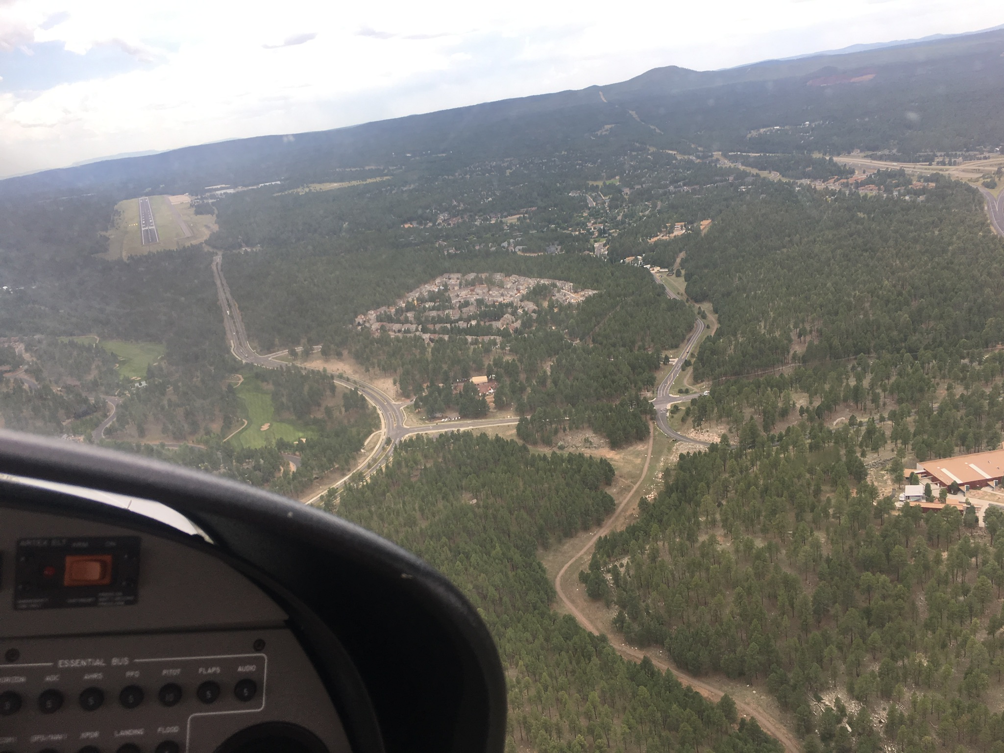
As we flew, we could easily observe the weather (we also had ADS-B In and ForeFlight on my iPad, which meant that we were seeing radar imagery in near-realtime, which checked out with what we saw out the window…more on this experience in another post), but we were not going to make it to our destination before sunset. As we got closer, the land rose and though we were cruising at 7,500ft and had started out near sea level at Lake Havasu, we were now only around 3,000ft AGL or less. Arrival procedures actually called for entering at 8,500ft so I was about to initiate a climb around 30nm from the start when ATC (by then it was Albuquerque Center who had just handed us off to Phoenix Approach) asked us if we were going to the fly-in. After telling them yes, they told us that traffic was light and that we should just proceed direct. This probably saved me a good 15 minutes of navigating by diminishing light, and made the process much simpler. Sunset came and went, and we got close to the airport to see it, though also it got dark enough that I could not see the shape of the airport and had to use its taxi diagram and beacon location to orient myself. A mere ten minutes from violating night flying currency rules, I landed (perhaps less smoothly than intended) at KPRC.
As it turns out, we were basically the last to arrive. With hundreds of airplanes (over 500, as we learned later), apparently everyone managed to arrive during daylight, while we avoided having to follow the complex arrival procedure (which disappointed me for the lack of challenge but also made us land sooner), we ended up paying for it in not having a marshall direct us to parking. The tower roughly told us where to find parking and we spent the next twenty minutes taxiing and pushing the plane around using flashlights. Finally parked and chocked, we were surprised to get a visit from an AOPA volunteer on a cart who drove us to the main registration tent — they heard us land, and felt bad that they couldn’t marshall us, so they came to pick us up.
The fly-in itself was the following day. It consisted of some exhibited airplanes, an aerobatics show, a lot of talks and seminars (from education to advocacy), and even some commercial and non-profit exhibitors in a tent. Some meals was served, and generally there was a mood of education and exhibition throughout. I’d say it was a cross between an air show, a conference with multiple tracks, and normal AOPA safety briefing seminars (i.e. the ones that give you WINGS credit). Well organized, for the most part. The whole thing was over before 5pm, and — interestingly to us — people started leaving around 1pm. There were indeed a lot of airplanes, with some on the grass and some on two ramps; there was even under-the-wing camping available for those brave enough to deal with the high altitude, wind, and possible precipitation. We wondered if the people leaving early knew something we didn’t about weather — perhaps they lived closer, or maybe they did indeed fly out early to avoid a small rain that passed through the area a few hours later.
Colorado River in the distance
We headed back early the following morning. After a small adventure getting to our plane and requesting fuel in an airport with two fuel trucks and dozens of planes trying to leave (and fill up), we took off. The weather promised to be fine, though parts of LA were supposed to be under a scattered layer of clouds at 3,000ft, and most of LA was showing expected moderate turbulence. Which, in a light Cessna, is not pleasant for an hour. So, we chose a slightly different route. Since we no longer needed to deal with arrival procedures, we departed basically south-west and proceeded towards Thermal airport just south of Palm Springs (and north of Salton Sea, which I’d wanted to look at for a while). It was a long and slightly monotonous two hour leg: few settlements below us, fairly repetitive terrain. Some rare exceptions was listening to Prescott controllers chew into Embry-Riddle students (KPRC is their home airport), or seeing the Colorado River wend its way towards the Gulf of Mexico.
We arrived at Thermal (again, a landing I wasn’t thrilled about, where I dropped the airplane from too high for my pride) and found the airport very hot, and nearly deserted. Coming from high-altitude Prescott and nice-and-cool Lake Havasu and coastal Hawthorne, this was a surprisingly hot place to be. We refueled and checked the weather. On approach, we heard folks complaining of high winds in the Banning Pass — enough that a Very Light Jet was questioning the turbulence — so I wanted an alternate path out. Instead of departing to the north-west, then, I departed to the south. This both gave us a better look at the Salton Sea (not much to look at, from altitude) as well as a trip past Borrego Springs (the valley was pretty flat and empty, in a fairly grandiose way). Funny enough, I kept having trouble with my ADS-B around then, and ATC took longer than expected to have time to talk to me, so I had a slightly uncomfortable ten minutes or so when I was climbing — and had reduced visibility — in a strange area in uncontrolled airspace and nobody was looking out for me except myself. Not that this is wrong to do, but I am so used to flying with flight following or in familiar areas that it felt odd.
The mountains to the west of Borrego Valley are surprisingly tall. We had initially intended to fly over them at 8,500 ft, but the peaks got pretty close to that altitude and were numerous. Plus it was hot and there was a bit of light turbulence, so I wanted to climb higher. In the end I decided to give myself extra room and climbed to 10,500ft — which was not all that easy for the 160hp Cessna that day. Until I played with the mixture, I actually stopped being able to climb entirely. The crossing to the coast was easy enough except a surprising amount of ATC radio traffic, and control instructions. They vectored us for traffic over the mountains, needed to know how we were going to avoid Camp Pendleton’s restricted area, where we planned to be in relation to Oceanside Airport, etc. Turns out there was an active parachute jump zone at Oceanside, so they had to vector me away and right towards the edge of the restricted area. Thank goodness for in-plane and on-iPad GPS to keep me from flying into trouble.
After Oceanside, the rest was pretty straightforward. We flew up the coast, had to comply with some instructions around John Wayne’s traffic, and then ducked under the (lightly scattered) cloud layer to get back to Hawthorne.
This was a fantastic trip. It taught me a ton about flight planning, about dealing with ATC on a long distance flight, about automation in the cockpit (and other non-automated duties, like checking the engine instruments, which I did with surprising to me regularity), about finding and using unfamiliar airports, and so much more. It also finally gave me a real airplane trip: the trip ended up being close to 6 hours in each direction, which was probably close to what it’d take to drive, but it was a ton more fun. It got me to a destination I wouldn’t otherwise visit (or three, if you count Thermal and Lake Havasu), and showed me a bunch of fantastic scenery that I wouldn’t see. It showed me new types of weather: Arizona high desert weather and clouds are quite different from LA. It showed me that you can have a trip be long and not too boring, and be challenging and enjoyable, and have a high workload and be relaxing, all at once.
Some things to consider:
My landings were too rough. Bad days, maybe? They should be smoother.
I could have calculated my fuel better, but instead I chose a plan that got me extra fuel so that I didn’t have to think too hard about limits. This meant that I probably spent an extra hour — or close to it — each way. The origin and destination were close enough to not have to land, and my fuel totals showed that I would been able to land with an hour’s safety margin. I stand by my flight plans, but I wonder if I can do better calculations in the future.
ADS-B and ForeFlight are not perfect. They are incredibly helpful, but don’t replace the need to look and listen.
I need to learn to lean better if I can’t twist the mixture knob. It’s uncomfortable to do this with one hand.
Where else can I go that’s far and fun? I have a tentative trip planned to Grass Valley (KGOO) to visit a friend, but that’s a long trip too.
It was time for me to undergo my club’s 6-month currency check. Basically, twice a year you have to fill out a form that shows knowledge of airplane parameters, takeoff/landing distances, fuel burn, etc, and then perform a checkout with one of the CFIs in the club.
On the advice of one of the other club members, I chose to spend the mandatory flying hour learning the Cessna 182RG that we have in the club. Our club rules require either having 25 retractable hours and a checkout with an instructor, or 10 hours instruction in a C182RG. Since I didn’t have either, I figured that every time I have to do a flight review or checkout, or any sort of training, I’ll do it in the C182RG and work my way to 10 hours over time (or get close enough to it and then just finish up).
So, my CFI and I did some ground school the previous week, and then came back and did the flying portion this time around. It was a day with broken clouds at around 3,000 ft AGL, but enough holes to get above the cloud layer to be able to perform maneuvers. We went up to altitude and did some stalls, emergency gear extensions, etc. Generally, the plane was not all that different from a 172 — I kept forgetting cowl flaps, and some specific checklist items were new, but generally speaking it did not feel too different from a 172.
There was one place where I got quite behind the plane. We did a landing at Compton, and after take off (and a crosswind turn, because you can’t depart straight out), I got disoriented by climbing above the broken layer, managing the plane, and navigating — after contacting Hawthorne (which I couldn’t see due to the cloud layer), I misreported my position. After my CFI questioned if that was correct (I had looked at the freeway intersection and called it one particular thing, which was wrong), I had re-contacted Hawthorne and reported an incorrect intersection again. This time my instructor said to just circle for a bit until I got my bearings.
To be honest, I still hadn’t figured out just which intersection I’d seen below me when he told me where I really was. At that point I understood why I was wrong — first, I’m not entirely clear on all the freeways in this area; second, I lost situational awareness around where Compton was north/south relative to Hawthorne: in my mind Compton was North of Hawthorne even though it’s actually a bit south. So when we turned left crosswind, I had assumed we were getting closer to Hawthorne while we were actually getting further. And, not having much ground to reference in the distance, I was misidentifying things left and right. Not my proudest moment. Though more importantly I was upset at myself for not making the decision to start circling in Echo airspace while I figured out my bearings: it would have been bad to bust the Bravo.
Altogether, though, it was great to get some time in a C182, and more retractable time. At some point in the future I’ll continue so as to get checked out as well as to get the high performance endorsement.
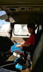
Sometime last year, after he turned 6 years old, I took Mateo to fly with me. I felt he was responsible enough not to mess anything up, and old enough to follow instructions, while I was experienced enough in taking passengers that I didn’t feel scared about taking a youngster. Mateo had the biggest smile I ever remember him having — one of those childhood whole face smiles of wonder that give you the impression of a profound happiness.
It’s been at least a year, if not more, since that time, and I’d been thinking of taking Mateo flying. However, it’s Father’s Day and so I wanted to spend some time flying. I had a trip in mind (off to the Salton Sea), and an alternative (up to Harris Ranch), or a yet another alternative (Catalina), but literally nobody to go with me. Some friends were busy, others were still a bit scared, and generally it was just last minute. I went to the airport and continued trying to think of friends who might want to come, or places to go without them. Somehow I was not feeling happy with creating a mission for myself around training (yet again), nor did I want to fly a long distance all by myself this time. A conundrum.
I got to the airport, started preflighting for my Salton Sea flight by myself (because, damn it, I don’t need others in the plane to enjoy aviation), but I guess I just couldn’t get it out of my head that I really wanted to be sharing aviation with others. So, I called Linda and had her pitch to Mateo that we go on a flight together! He agreed, and so we made a plane.
I preflighted, and took off from Hawthorne, and landed in Santa Monica. Then parked at the observation deck, and waited for Mateo to come. Then, we both went to Santa Barbara for lunch!
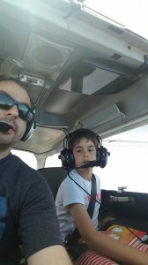
June 2016 — Mateo’s second flight with me.
It was a great flight. On the way there, we flew north remaining just a bit west of Van Nuys’ airspace, and climbed to 8,500 (slowly, since the airplane is only 160hp). The weather was great, and even though the sun was shining, it was pretty cozy at altitude. We followed the 101, flew over Camarillo and Oxnard, and looked around a lot. I let Mateo fly for a little bit (pitch and bank), which I think he enjoyed. We talked about some gauges and what my plan was — even though it took an hour, I think that I kept his interest. We landed at KSBA at 15L, parked over at Atlantic, and then walked to lunch. I think this leg of the flight went without any problems, other than me filing but not properly activating the flight plan. I remained in contact with ATC the entire way, but it is worth double-checking that you’ve got all the protection that you intend to have, always. About the only issue was that I recently bought a Kore Audio KA-1 headset for use by passengers (since the club’s headsets just suck), but the headset kept generating noise. This meant that it was harder to hear each other and ATC over the constant white noise, and was harder to tolerate over time. I need to email them to sort this out.
When we got back from lunch, Mateo was a bit more tired. We took the coastal route — cruising at 5,500ft this time, from Oxnard to Pt. Mugu to Malibu to Santa Monica, then taking the mini-route back to Hawthorne. Landed, refueled. What a nice and successful Father’s Day!
I had a short flight scheduled, and figured I’d go somewhere for lunch and come back. Maybe half an hour there, and half an hour back. However, I show up and the plane I have reserved is sitting there on the ramp with its cowling off. Apparently, there was something during the previous flight that required a bunch of attention — the scheduling software showed it as resolved, but the cowling suggested something else entirely. Since the problem was loss of electrical power, I didn’t want to presume it had been fixed.
So, I was bummed. I checked the schedule and the other plane was taken by someone else, and only the 182s were available. I am not checked out in them, so no-go. Just as I’m about to leave though, I see the other person going for the 172. He sees me all sad, and offers to switch: he can take one of the 182s while I take the remaining 172. He’s only planning to do an hour of pattern work, anyways.
Of course while we do all that switching and deciding, my time is ticking down. So by the time I take off, I only have enough time to spend doing an hour of landings. It had actually been a long time since I’ve done nothing but landing practice! I did some soft field takeoffs, attempted a short field landing, did a go-around. Also, for the first time since my PPL, I did a no-flap landing — partly inspired by the very real situation the person who flew that other cowling-off 172 had experienced the other day. There are times that the pipers with their Johnson bar have it right.
All in all, an hour of pattern work got me 6 landings and a go-around, which was great practice. Not every landing was as good as I wanted them to be, but none of it left me feeling unsafe or upset at myself. All in all, a good day.


 Second, I needed a route. To cross the Rockies, I decided on a flight through
  We departed on Wednesday morning, running about 90 minutes behind schedule. This was Linda’s first long flight with me (and the first flight in the new airplane), and Roan’s second flight with me (and also the first in the new airplane). Departing from Santa Monica was pretty easy, despite a few clouds in the area, and we proceeded through the Banning pass climbing up to 9,500 ft, and then proceeded direct to overfly Lake Havasu. That’s when we ran into some turbulence, and some scattered precipitation. I have two sources of in-flight weather: ADS-B In (from a Stratux), and


 Our intent the next morning was to a) leave early enough that the thunderstorms don’t start developing yet, and b) go to
  Amarillo (which for some reason is pronounced with “L” sounds and not “Y” sounds) is in the Texas Panhandle, and is basically directly east of Albuquerque. We climbed to 11,500 ft and cruised over to Amarillo without any problems. Amarillo was impressive in that it was an airport seemingly in the middle of nowhere, and yet there was so much traffic reported by the tower that we were sent on a very long downwind and then asked to do a 360 for spacing. Right above the airport was the meeting point of a bunch of Victor airways — 10 radials of the on-field VOR are used as airways — and so there was high altitude jet traffic as well as low-level airport traffic. The airport was also a hub for military airplanes: we parked at
 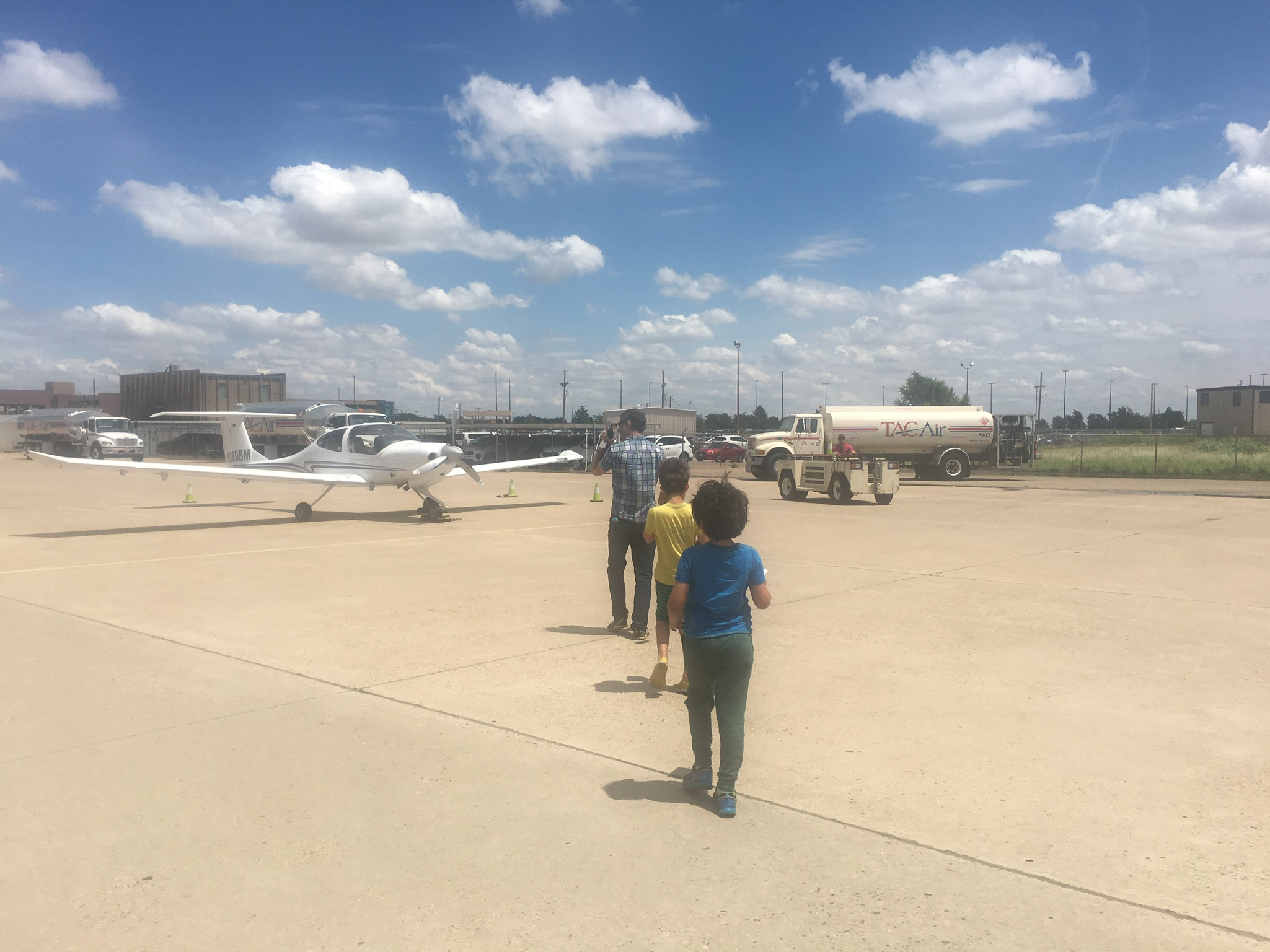 Liberal was still not a good choice, but we were far enough east that we could head northeast without running into the weather. I was originally hoping to get to Kansas City that day, but my fallback was Wichita and so that’s where we headed due to distance and time considerations: I didn’t want to have a 3-hour flight where a 2-hour one would suffice. We climbed to 9,500, but then realized that the cloud layer was in the way — and so both went around and decided to go under it, since ceilings for the rest of our path looked to stay high enough. We eventually dropped down to 5,500 ft, and then even to 4,000 ft (which was less than 3,000 above ground) to avoid clouds.
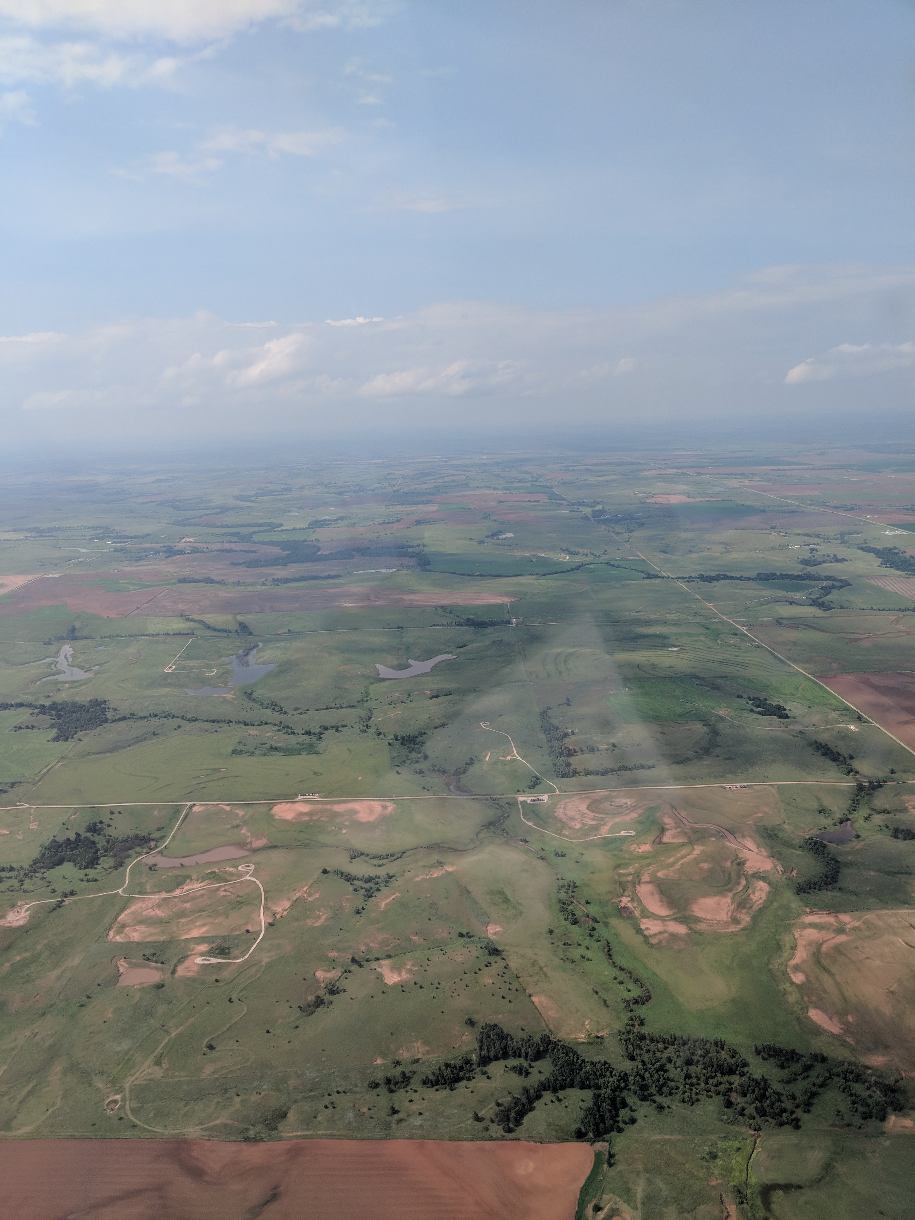 Wichita was a pleasure to arrive in — the land below turned green and lush, and it was becoming evening-time. However, there was a nasty cross-wind and we landed a bit rougher than I had wanted (nothing that my passengers noticed, apparently, but enough that I was unhappy). Another thing that was unhappy was my fuel pressure gauge, which took the opportunity of the landing rollout to start going haywire: showing zero, max, correct readings, and alternating between different ones multiple times per second. This was accompanied by audible ding-dongs from the G1000 system. We were on the ground, though, so I taxied to the FBO —
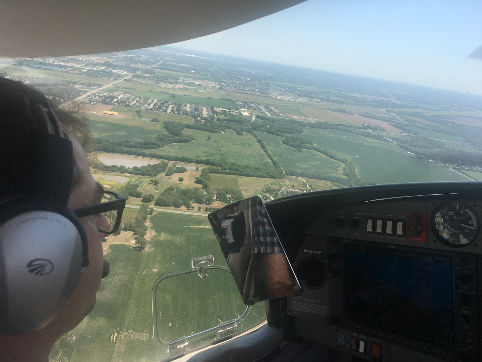 After some back and forth, the Yingling folks have taken off the fuel pressure transducer, cleaned the contacts, and started the engine to see everything working well. So, we decided to call the problem done. We spent the evening walking around Wichita’s river bank, looking at the


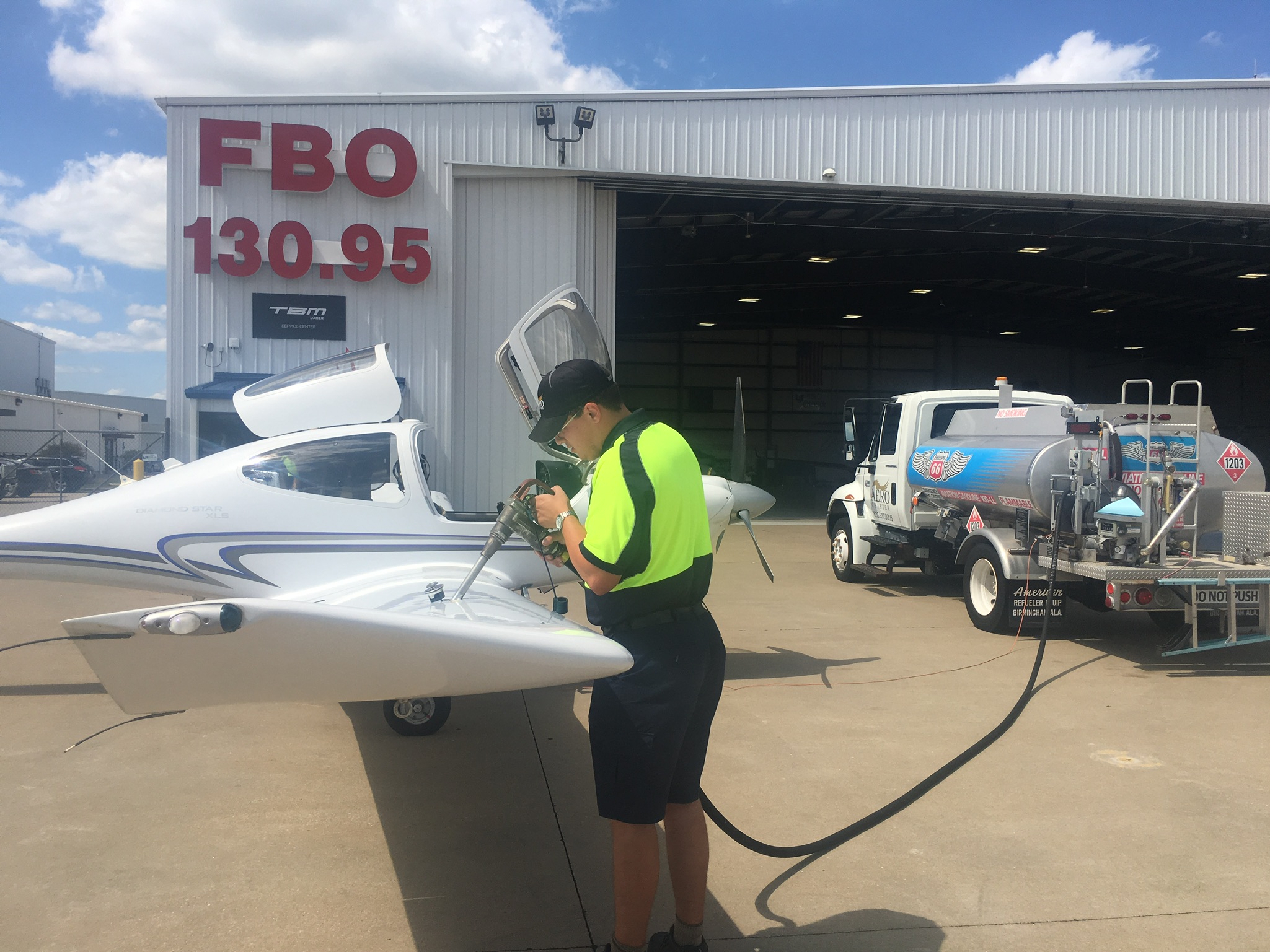 After getting our fill of St. Louis, we climbed back aboard for another two-hour hop to Chicago. Initially, I wanted to end up at the DuPage Airport near Chicago, though from past experience this is actually not a convenient place to downtown and would have required a pricey Uber ride. On the other hand, the airport in Gary, Indiana, was billing itself as the “Gary/Chicago” airport and boasted a 30 minute distance from downtown. There was also a threat of some weather around the city, so we aimed at Gary.
 Immediately after takeoff, the fuel pressure problem started again. Though distracting on takeoff, I quickly analyzed it again to not be a real fuel pressure problem, and decided to continue on to our destination — choosing an FBO at Gary that advertised maintenance services. The flight was smooth, though the incessant beeping from the fuel pressure alarm was incredibly annoying. I ended up keeping either myself, or myself and Linda, isolated from the kids so that they could watch movies or read in peace while we (or I) dealt with the beeps.
 We arrived at Gary shortly after sunset — this was my only evening landing, as it happened. There was absolutely no wind, and I made perhaps the smoothest approach of the trip.
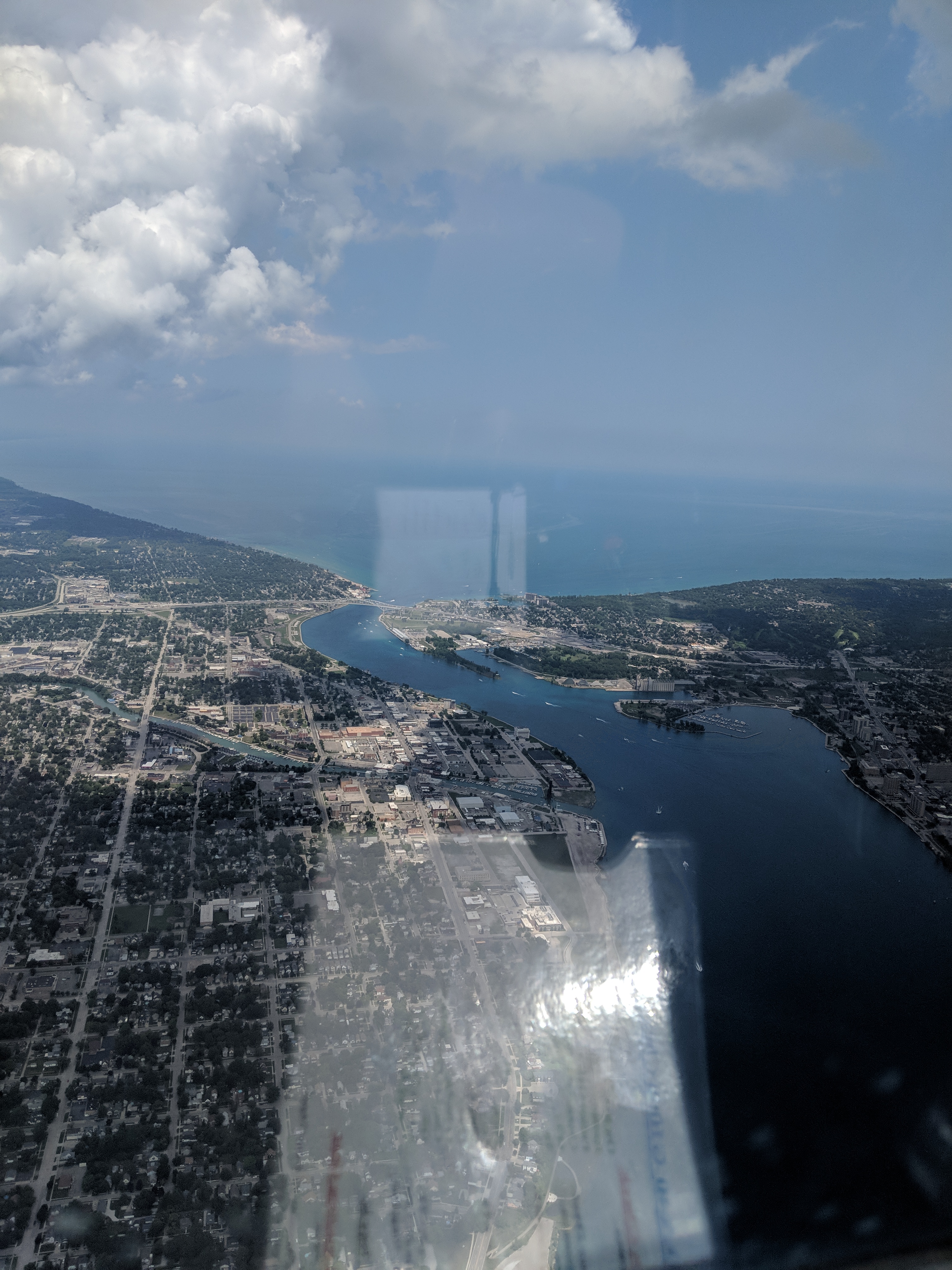

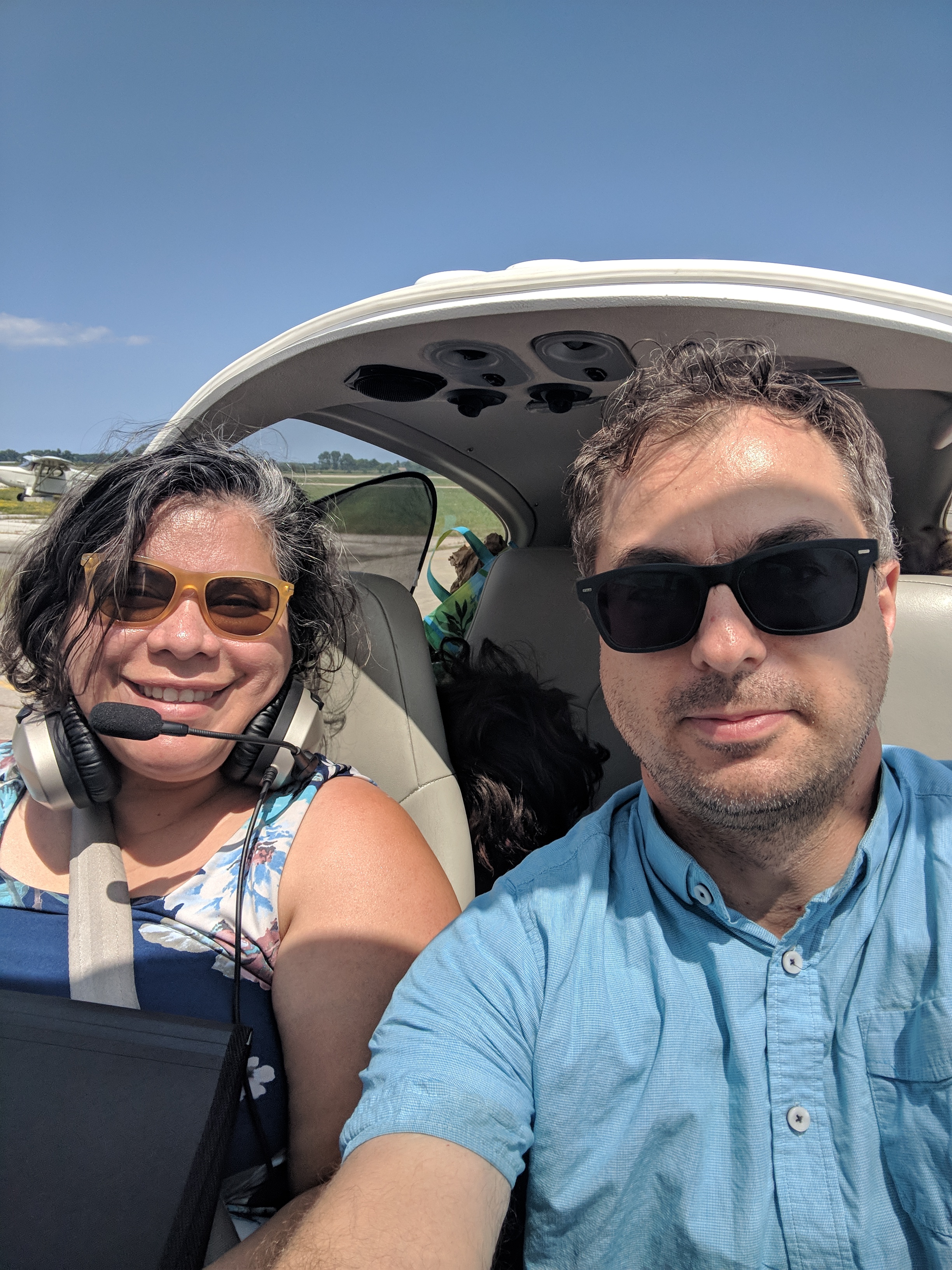
 Very fortunately, I only waited 5 minutes on the phone until some nice Canadian border people heard that we landed and told us Welcome to Canada, gave us a reference number for the entry, and that was it. We disembarked, and Linda and the kids went into the FBO (Huron Flight Centre — really just a flight school, I believe). I stayed behind to get the plane fueled using a pump denominated in liters rather than gallons. Fun times ensued.
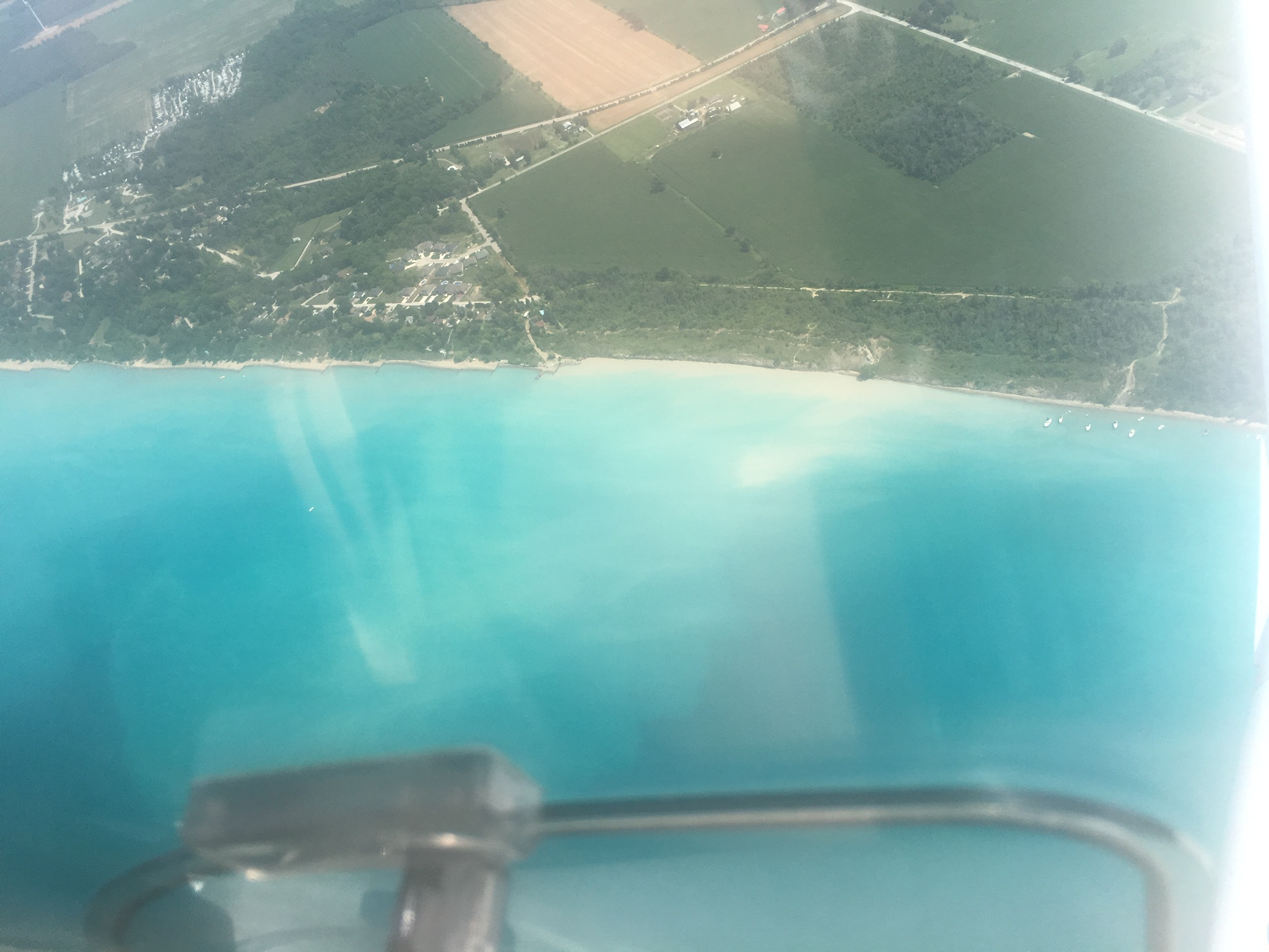
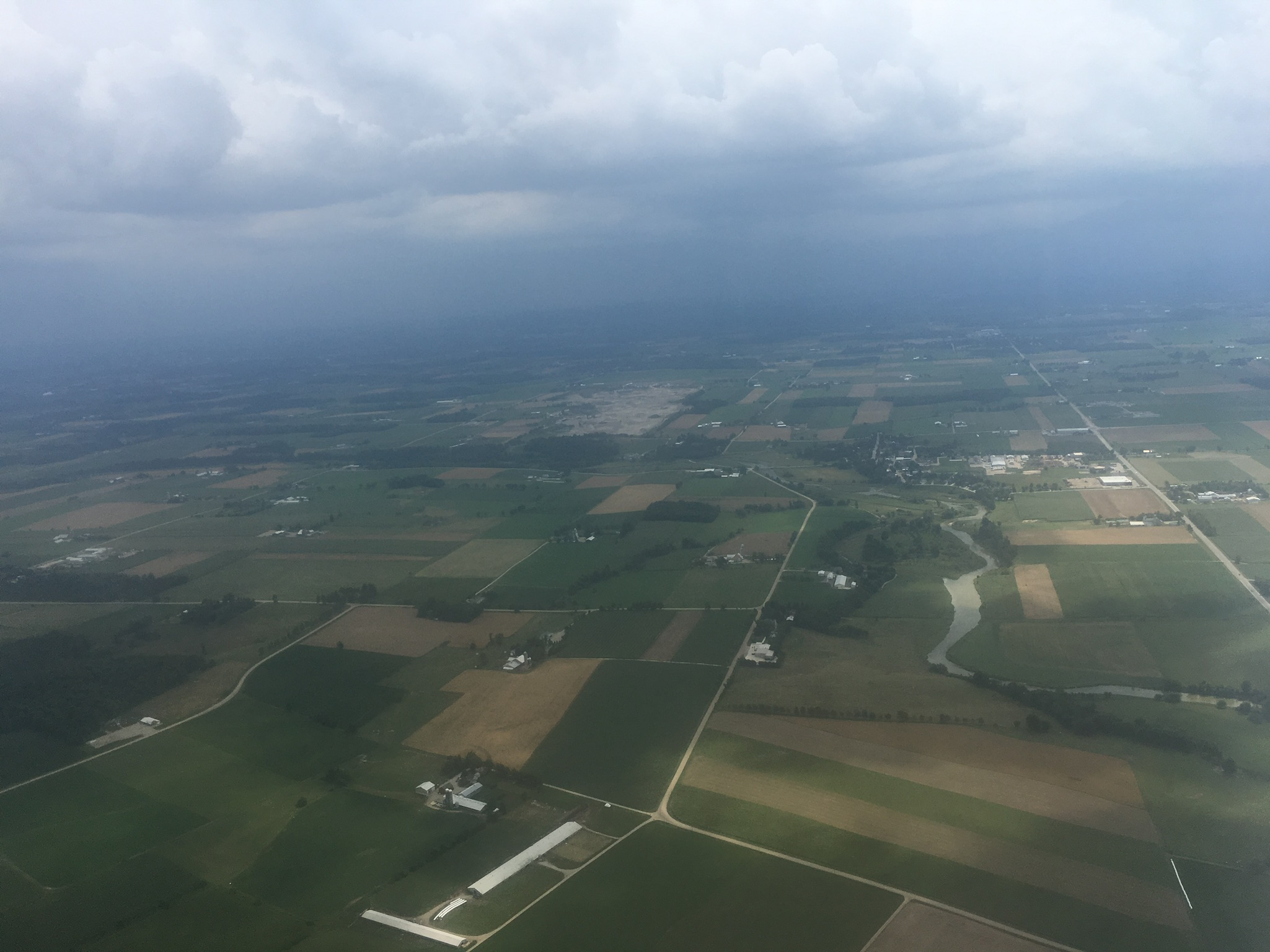

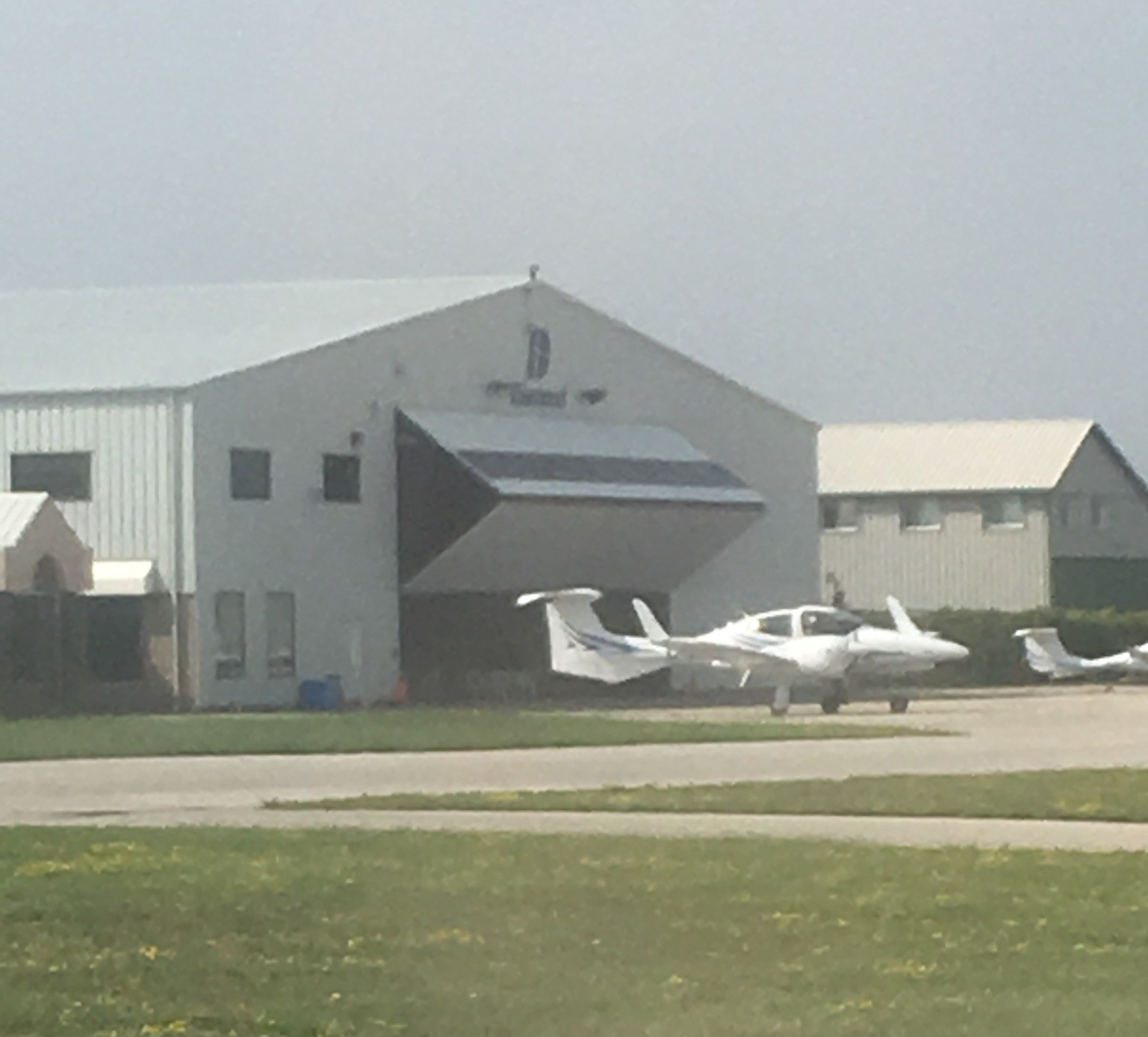
 After we’d stayed in Oakville and hung out with relatives, and after my maintenance was done, and after I’d visited friends in Toronto proper, it came time to leave. We took the train to London, and (after my test flight) filed the proper notices for re-entering the US. This time I had to file a flight plan (by phone, with the Canadian flight service), and also fill out the eAPIS for the US, and call the border patrol to tell them of my estimate and location for entering the country as well as our identities. I paid our bill, we loaded ourselves into the airplane, and took off.
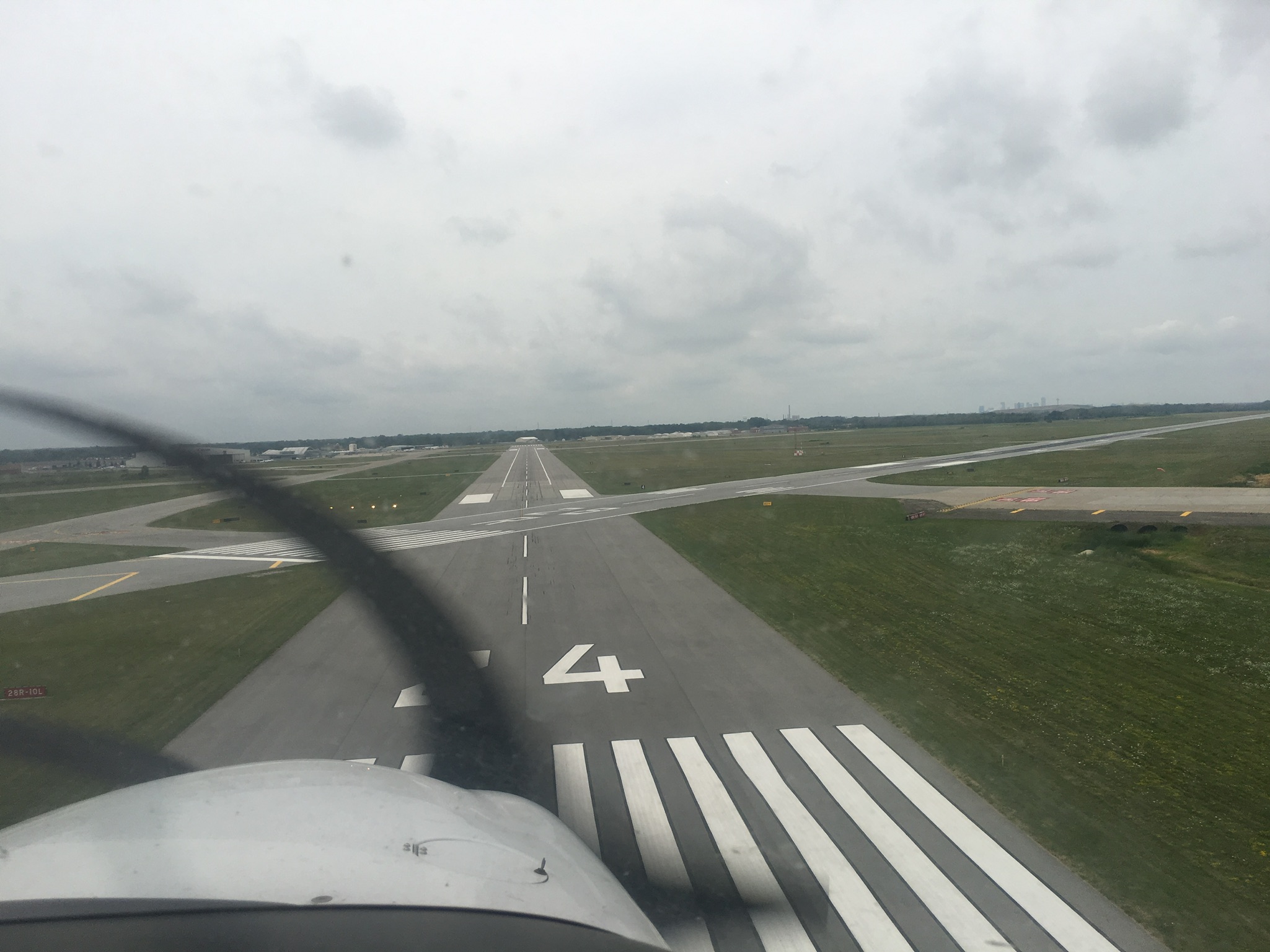


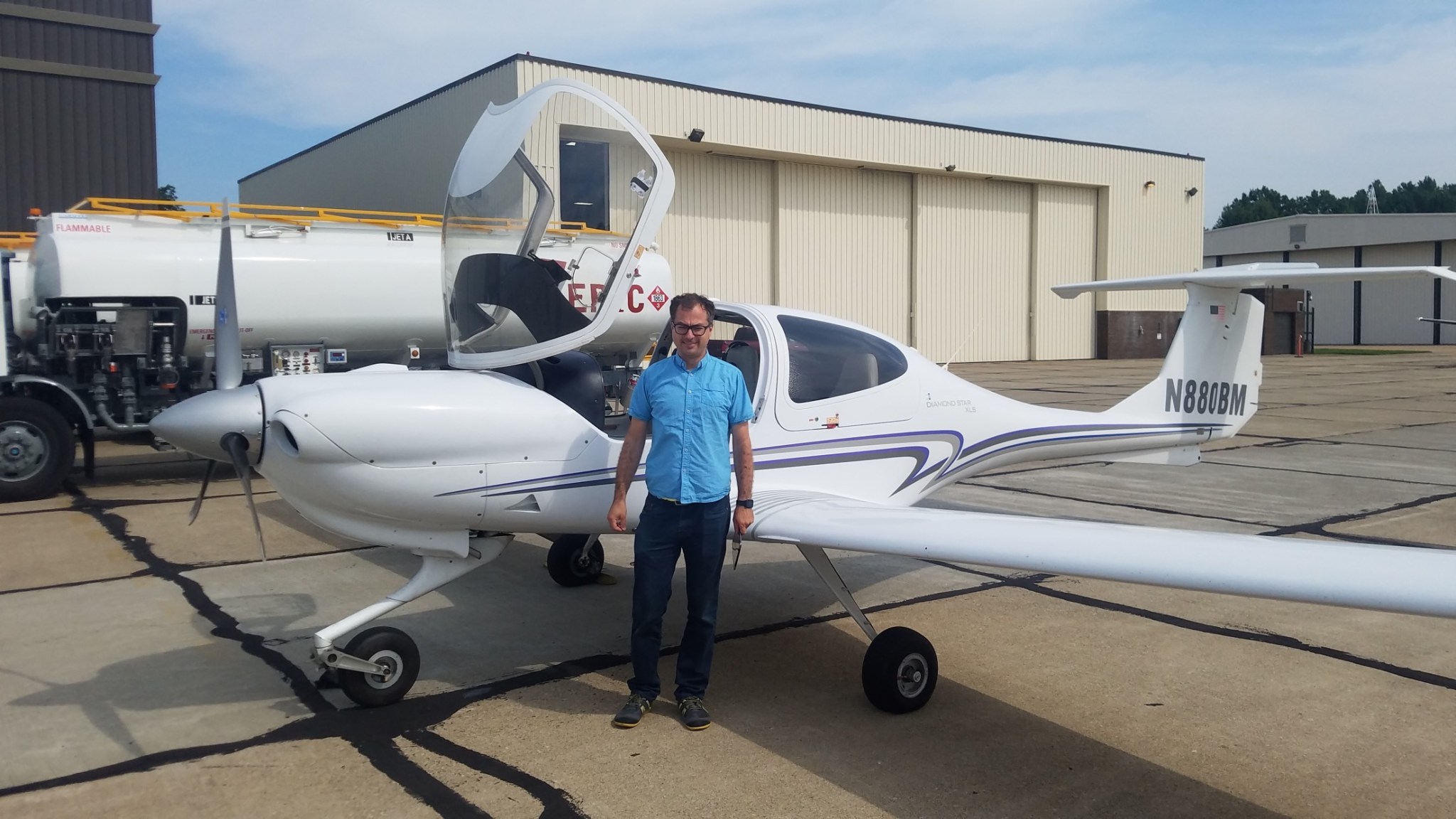

 The next flight of the day took me to

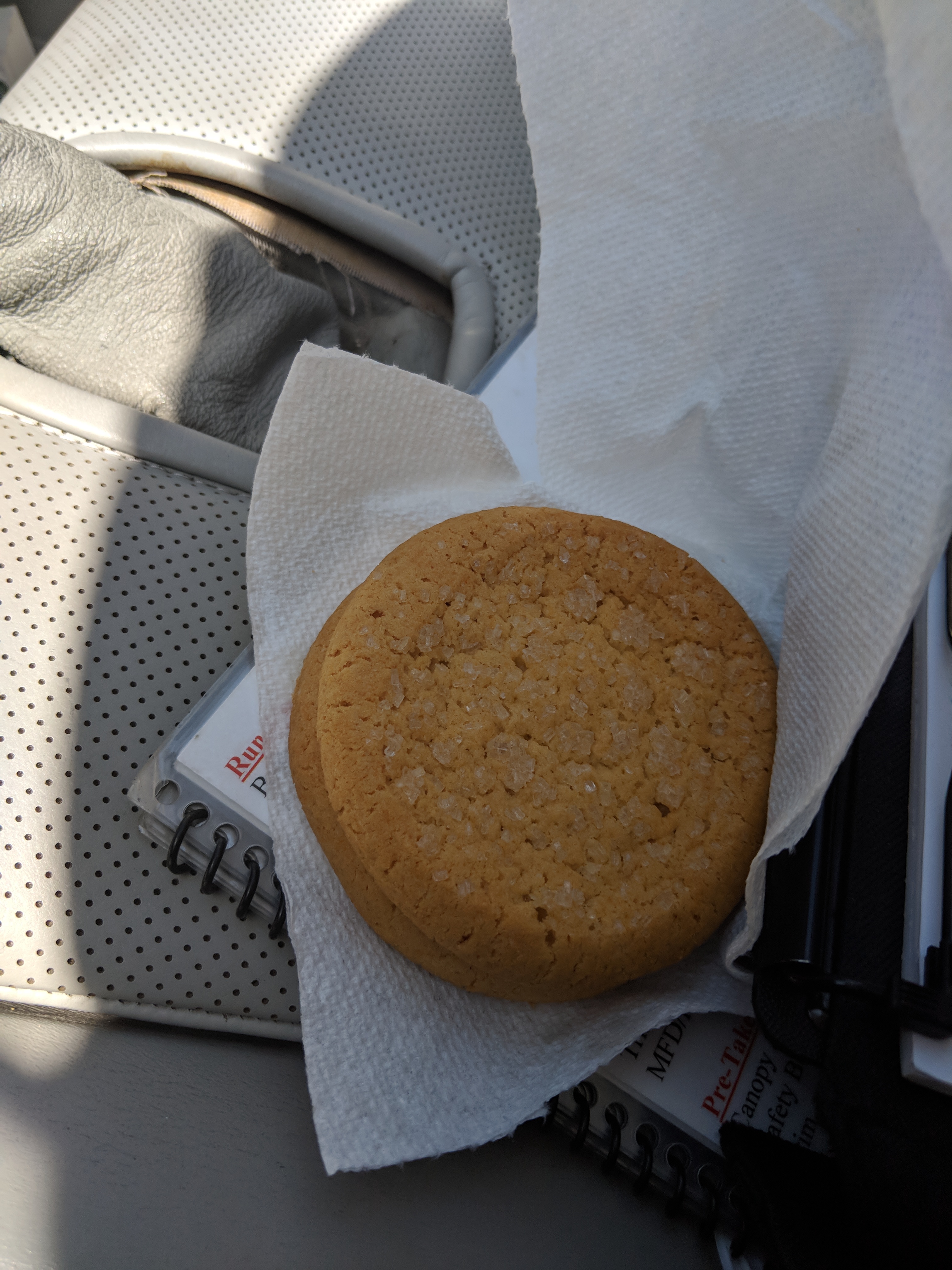 A note about cookies. The FBO had a box of them and welcomed me to have some. Since I was hungry I ate one, and grabbed two to go. On this three hour leg to Santa Fe, I ate one cookie when I had two hours to go, and another with one hour. Yum!
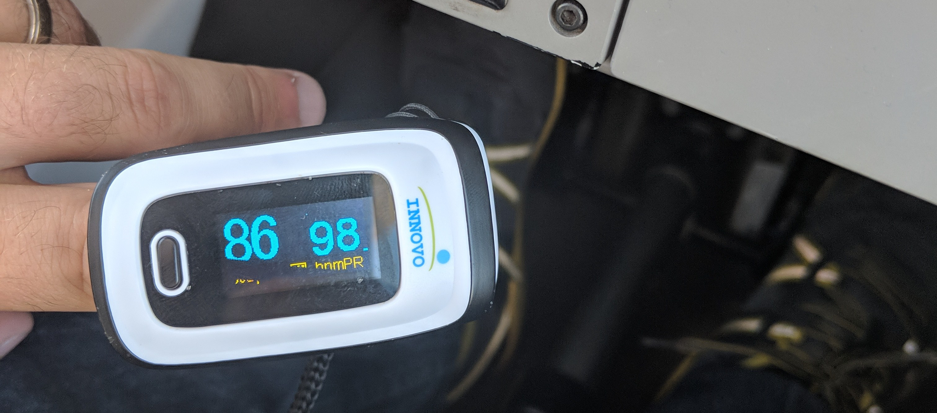
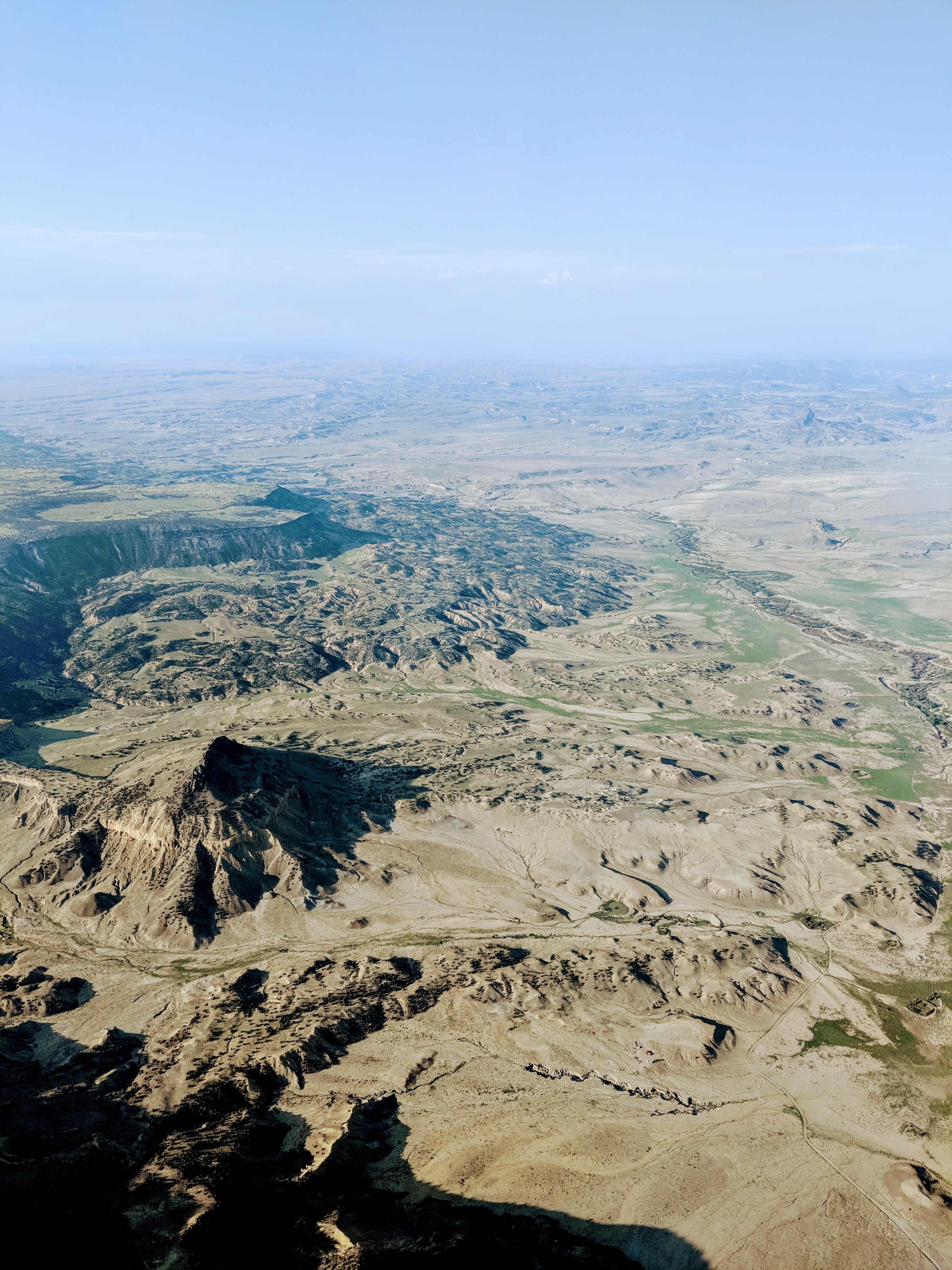 I had initially filed to
  Lake Havasu is untowered. ATC let me go about ten miles out and I landed in the hot desert with a few other planes in the area.


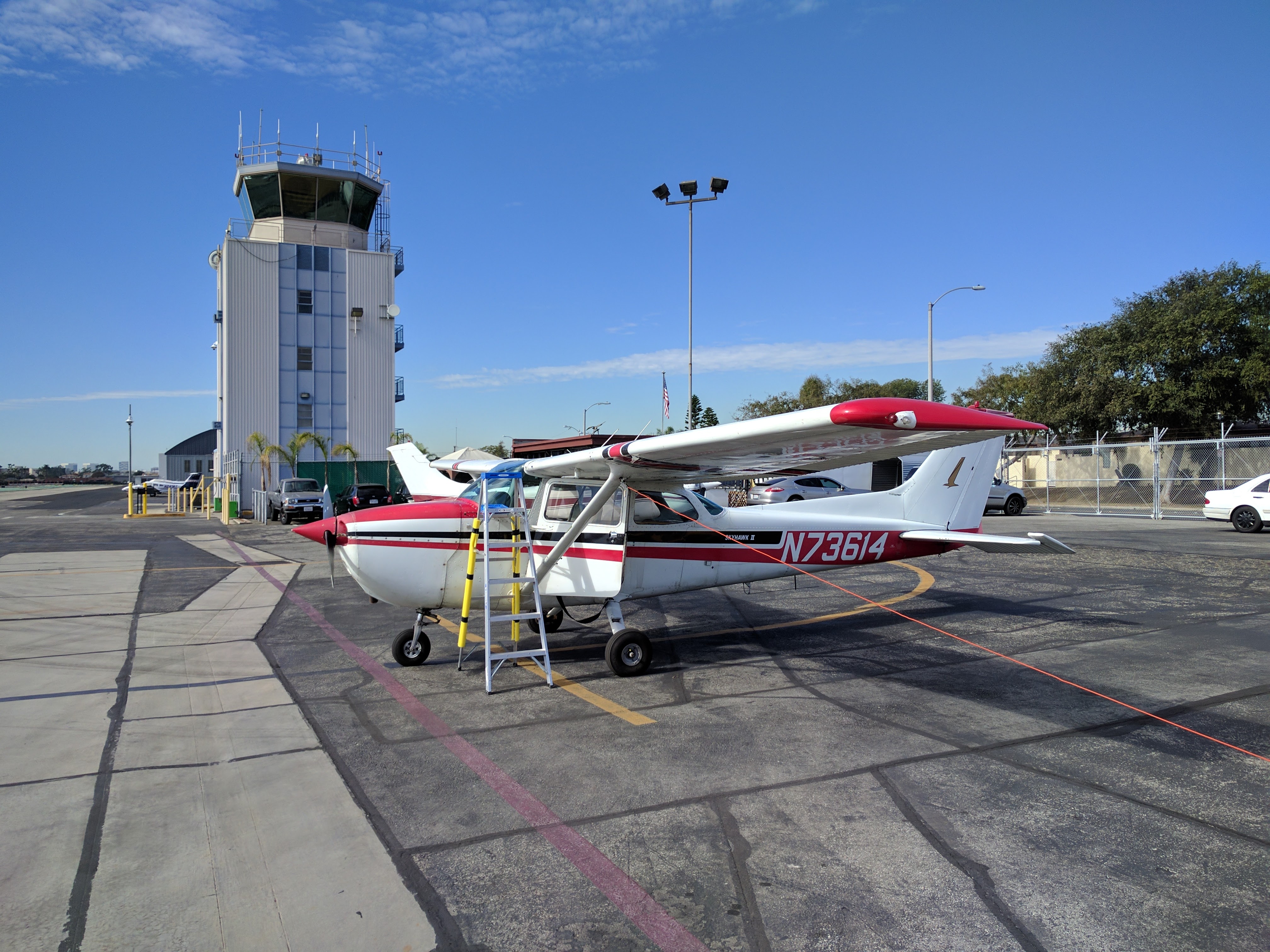


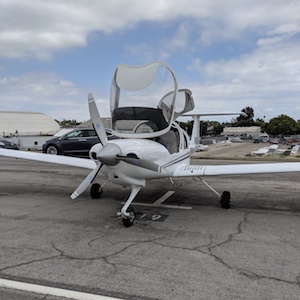 Joys: it’s an awesome looking airplane. It’s a fantastic flying airplane, and one that I’ve loved ever since I found out about them. I’d gotten a few hours of DA40 training a few years back, and mostly found it awesome except the free-castering nosewheel and the heat in the summer, but those were compromises I was willing to make for the performance and fit for me. Tears: It’s not a perfect airplane by any means: this particular airframe was a flight school plane in the past and so has lots of hours and some dings in the paint around the composite structure. Joys: It’s got fantastic avionics, and is comfortable in the front and back. Tears: it has rather crappy weight and balance issues where I can’t load it with four adults and remain within CG limits, or weight limits with any reasonable amount of fuel. Even with two adults and two kids I have to fly with partial tanks (basically with 4 hours of fuel instead of the nearly 5 I could normally take). Joys: I have a parking place for it in Santa Monica. Tears: I’ve had to pay for inspections, little things that needed fixing, database updates, etc, and can see the trajectory of this. Joys: it’s mine! Tears: actually it belongs to an LLC that’s owned by me and I now have to deal with a corporate entity. Joys: I get to wash it and make it clean and sparkly. Tears: I have to wash it, or it gets dirty and grimy.
 s and non-members to come together for a day of aviation stuff. Last year’s (to which I couldn’t go) was quite close — in Chino — but this year’s closest one
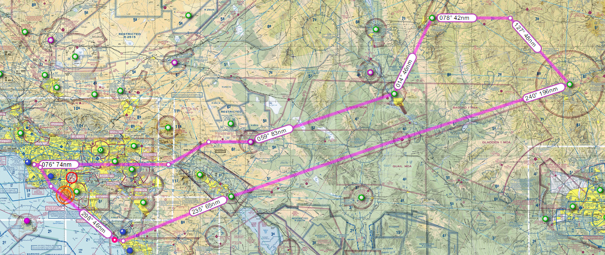
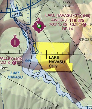 The Lake Havasu City airport is a nice, single runway, untowered airport north of Lake Havasu City (unsurprisingly positioned on the banks of Lake Havasu). I’ve never been anywhere near that area — by car or otherwise — so it was fantastic to be able to observe it from the air and get the sense of the water and land features. The airport was pretty quiet, with another plane that landed just before us. We landed, taxied to Desert Skies FBO and filled our tanks. The FBO had water and air conditioning — which was nice, even if our flight wasn’t actually that dry or hot due to altitude. We paid for fuel, and headed out. Some other airplane on frequency was also heading to Prescott for the fly-in, though I forgot his tail number and so we never met up.
 complex arrival procedure (which disappointed me for the lack of challenge but also made us land sooner), we ended up paying for it in not having a marshall direct us to parking. The tower roughly told us where to find parking and we spent the next twenty minutes taxiing and pushing the plane around using flashlights. Finally parked and chocked, we were surprised to get a visit from an AOPA volunteer on a cart who drove us to the main registration tent — they heard us land, and felt bad that they couldn’t marshall us, so they came to pick us up.
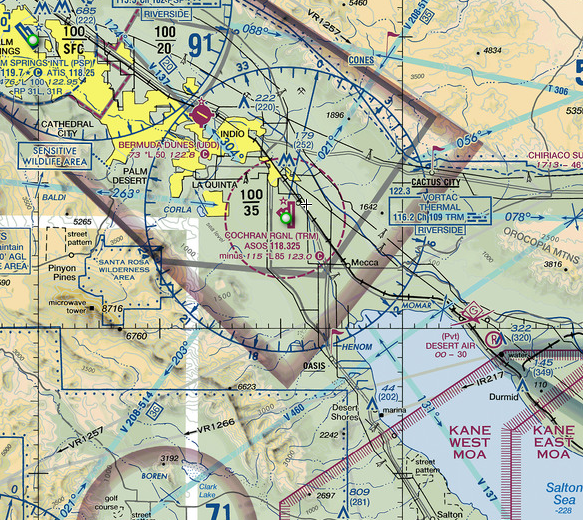 Coming from high-altitude Prescott and nice-and-cool Lake Havasu and coastal Hawthorne, this was a surprisingly hot place to be. We refueled and checked the weather. On approach, we heard folks complaining of high winds in the Banning Pass — enough that a Very Light Jet was questioning the turbulence — so I wanted an alternate path out. Instead of departing to the north-west, then, I departed to the south. This both gave us a better look at the Salton Sea (not much to look at, from altitude) as well as a trip past Borrego Springs (the valley was pretty flat and empty, in a fairly grandiose way). Funny enough, I kept having trouble with my ADS-B around then, and ATC took longer than expected to have time to talk to me, so I had a slightly uncomfortable ten minutes or so when I was climbing — and had reduced visibility — in a strange area in uncontrolled airspace and nobody was looking out for me except myself. Not that this is wrong to do, but I am so used to flying with flight following or in familiar areas that it felt odd.